
Our northern California excursion made leaving much harder. We realized that there were so many more adventures we wanted to go on while in California. Unfortunately, the timing did not work out. We will be back someday.
Our route was just shy of 1000 miles, at 982. We averaged approximately 16 mpg for the trip. Abby felt very sporty without the cargo trailer.
Campgrounds
- Plumas-Eureka State Park: 2 nights
- Manzanita Lake Campground, Lassen Volcanic National Park: 2 nights
- Sarah Totten Campground, Klamath National Forest: 1 night
- Mill Creek Campground, Redwood National and State Park: 1 night
- Mad River Rapids RV Park, McKinleyville: 1 night
- Hidden Springs, Humboldt State Forest: 1 night
- Westport-Union Landing State Beach: 2 nights
Breweries
- The Brewing Lair – Amazing setting. Hop forward beers.
- Woody’s Brewing Company – Biggest surprise. All the beers were well done.
- Lost Coast Brewery – Not much has changed since we were here six years ago. Except the town is a little more down on its luck.
- Six Rivers Brewery – Chili beer has some kick. Nice fruit beer and sour.
- North Coast Brewing Company – Great beers and food. Even better than we remembered it.
Favorite Campgrounds
- Wesport-Union Landing State Beach: Our favorite campground of the trip. Camped on a bluff, overlooking the Pacific Ocean, falling asleep to the sound of the ocean. What more can you ask for? Beach access? Even better. Fantastic campground that the locals know about. You can grab a spot as soon as someone leaves. Make sure there isn’t an item left at the site indicating that a camper is coming back.

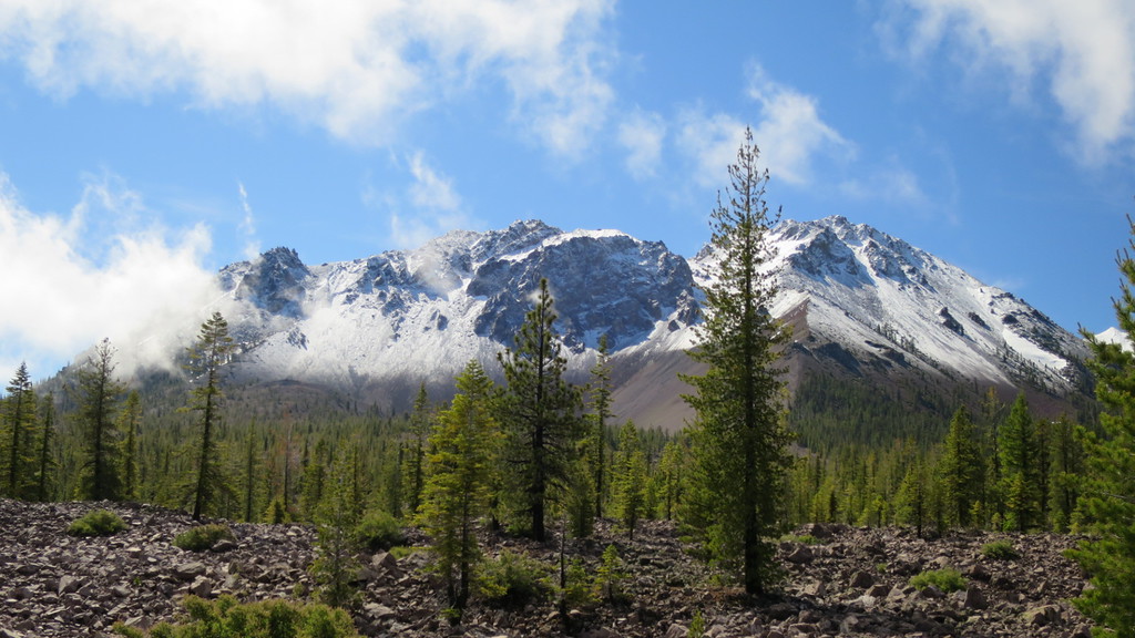
Beach that can be accessed from the Westport-Union campground. - Manzanita Lake Campground, Lassen Volcanic National Park: Our second favorite campground. This park has versatility. Hiking, skiing and snowboarding (in June!), and lake activities. A very nice park and informative visitors center. Really enjoyed our hike up to Crags Lake. Other trail-heads accessible in or near the campground; other trails through out the park.

View near Crags Lake. -

Stand of young redwoods. Mill Creek Campground, Redwood National and State Park: Some sites were in some very dense tree cover. We had a sunnier site with a creek directly behind us – Alex loved splashing in the water. Lots of hikes accessible from the campground.
Biggest Pleasant Surprise
- Hidden Spring, Humboldt State Forest: Primarily tent camping and some smaller RV and trailers. Abby is only 24 feet and we were glad she wasn’t bigger. We could hike to a beach/swimming hole at the Eel River. Sites are well spaced.
Least Favorite Campground
- Mad River Rapids RV Park: Commercial campgrounds are not our first choice. But there was cell service here and that is what we needed for Jess’ phone interview. So here we stayed.
 We did not do this drive in one day. It actually took us two. We stopped and stayed at


 Westport Union Landing State Beach has, well, the beach. This can be walked to and at low tide you can find sand crabs, crabs, giant anemones, and mussels. Alex took a little bit to warm up to the beach and preferred to walk on the harder sand exposed during low tide. Once he discovered this surface, he was eager to run up and down the beach. The dogs were excited to frolic in the surf.

 Route: CA-96W, Indian Creek Road, US-199S