Distance/Elevation/Difficulty: 2.0 miles (one way)/+971/Most difficult
Time Elapsed: 120 minutes.
Comments: This is our first visit to Golden Gate Canyon State Park. We came in off of Gap Road, and it would have been better to come in at the visitors center for our inaugural visit. We found our way to Mountain Base road and stopped in Bootleg bottom (named for the bootleggers that used to operate out of the area). We decided to try the Coyote Trail since we conveniently parked at the trail head.
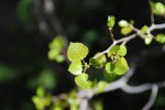
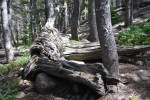
The trail starts out deceptively simple. A smooth trail along side some mountain meadows lined with Aspen. Soon the trail heads into the woods and the difficulty increases to moderate – it is rockier but nothing to strenuous. Then the difficulty increases again, with a scramble up some rocks where care must be taken. Unfortunately, weather started to blow in and we were not prepared for hiking in freezing rain/snow. Or going back down a wet rock scramble while packing Alex. We opted to turn back for safety reasons and did not make it to Frazer meadow.
Would we return? Definitely. We really enjoyed our abbreviated hike. We look forward to coming back with an earlier start.
Gallery
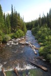
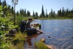
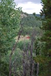
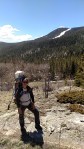
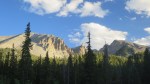
Starting out on the coyote trail. We think we’ll be headed up that way.
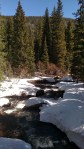
The meadow at the beginning of the trail
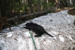
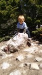
Alex investigating the remains of a bootlegger’s car.
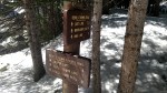
Historical sign by cabin (not pictured).
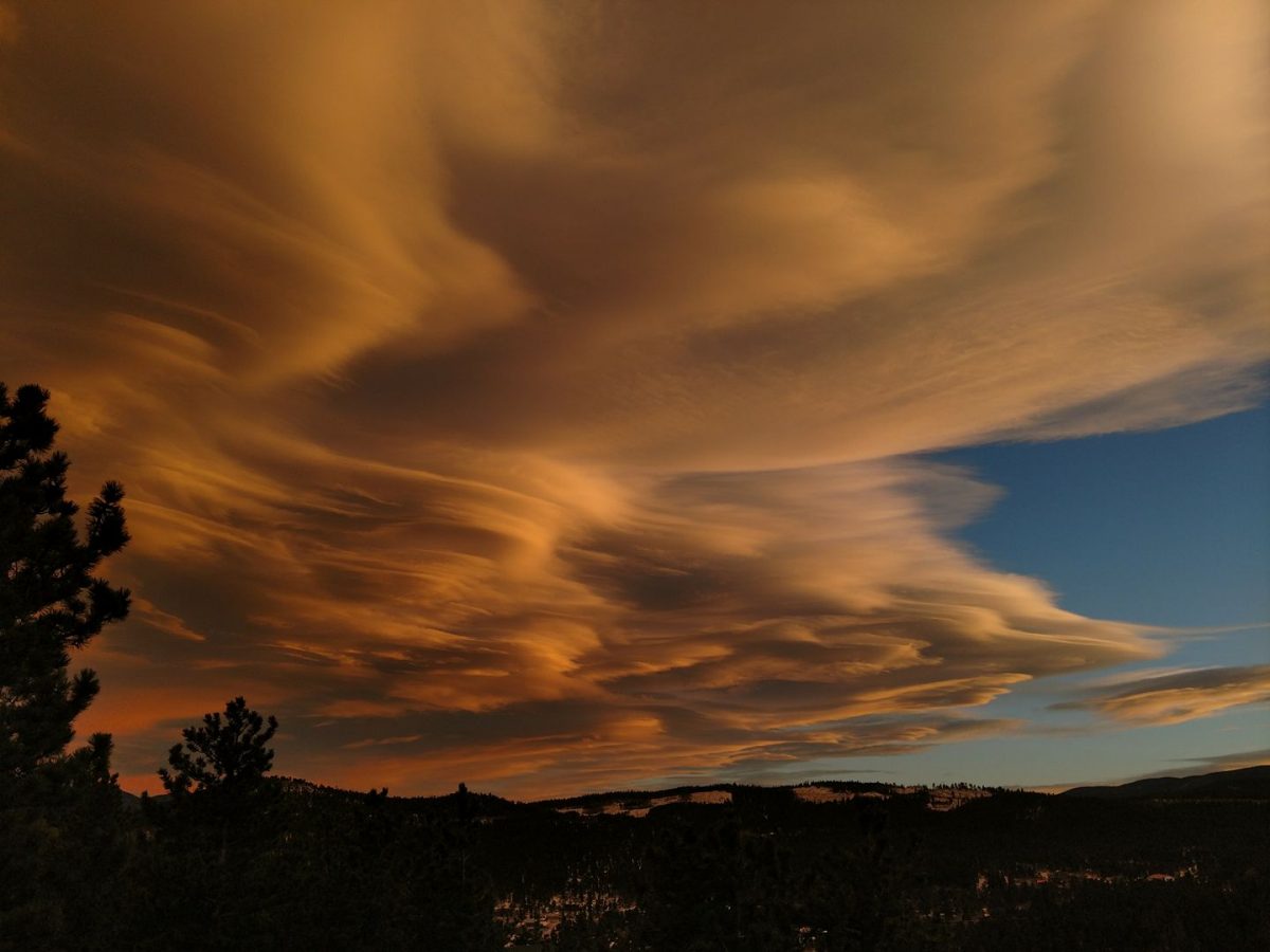
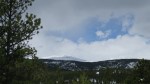
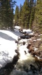
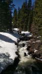
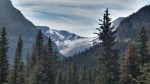
View from the rock scramble. The weather is coming in.
Distance/Elevation/Difficulty: 4.3 miles (total)/~180 feet/Easy
Time Elapsed: 180 minutes.
Comments: This was a beautiful hike that was even more enjoyable since we were hiking with friends. Based on their advice, we arrived at 9 am in the Brainard Lake parking lot. The Long Lake lot was already full and the ranger said a 6 – 6:30 am arrival was needed to ensure a spot in the Long Lake lot! This is not happening with Alex. Starting at the Brainard Lake lot added 1.5 miles round trip to our 2.8 mile hike, so be prepared to for a longer walk. The Long Lake Loop is also known as the Jean Lunning Loop.
Alex did great and hiked approximately 3.5 miles (out to the trail, the trail, and was carried from the trail head to the parking lot). In general, the trail is smooth and wide. There are some wooden bridges above swampy sections, but they are very sturdy. Leashed dogs are welcome and all pups we encountered were very well behaved. Alex dipped his toes in the lake and confirmed it was cold. Despite the chilly, he had a great time wading in the lake.
Would we return? Definitely. The road up to the recreation area is good and there is a campground. We hope to bring Abby up soon for a long weekend so we can get an early start and go on longer day hikes. Another option we look forward to is taking a picnic to Brainard Lake – no hiking, just Alex splashing in the water.
Gallery
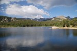
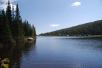
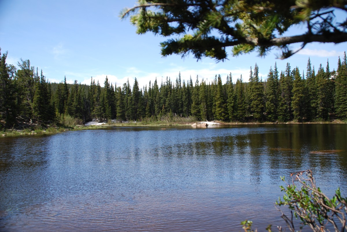
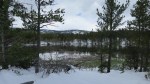
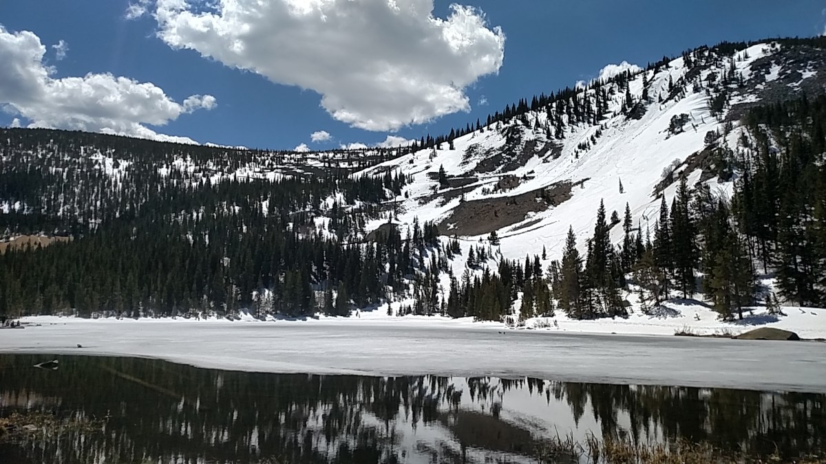
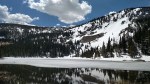
Outflow of Brainard Lake.
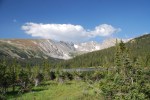
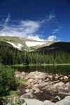
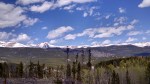
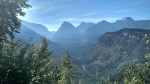
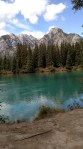
View of Long Lake and Niwot Ridge.
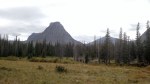
South St. Vrain Creek with Apache Peak (13,441 ft) and Shoshoni Peak (12,967 ft).
Destination: Rainbow Lakes, Roosevelt National Forest
Date: 8/13/2017
Time of Day: 9:45 am start
Distance/Elevation/Difficulty: 2.6 miles (total)/~396 feet/Easy
Time Elapsed: 180 minutes.
Comments: This is the second time we hiked (or tried to hike this trail). Our first hike was almost two months ago, the first weekend that the trails and campground was open. It was a madhouse. This weekend was much quieter: we were able to get a parking spot in the trail head lot, campground was not full, and there were fewer people dispersed camping along the road to the trail head.
We were actually hiking at 9:45. Out of the house by 9:15 and the road was much improved compared to two months ago. It seems like gravel was brought in and a road grader touch the surface to help reduce the bone rattling drive. We would actually think about bringing Abby up the road (if poor Abby was in running condition).
As with our first trip, the trail is still poorly marked and the multitude of social trails just add to the challenge. Following the trail was easier this time with the snow fields melted away and down trees cleared. We clearly saw where we lost the trail on our first hike and where the trail went. It is no wonder we lost it, two months ago it was covered with snow. With the snow gone it was little more than a goat path through some rocks.
As the trail heads down to the second lake, there is an option to take the second switch back and go to the lake shore, or continue on straight towards the third and fourth lakes. The distance between lake 1 and 2 is very close, it is a longer hike from lake 2 to 3, and lakes 3 and 4 are adjacent. There is a fifth lake close to lake 4, but we did not pick out the trail to head that way.
While we were dipping our toes in the frigid water of lake 2, fellow hikers shared the report of a moose sighting in lake 4. Alex, who desperately wants to see a moose, led the way. Unfortunately, we arrived at the lake after Mr. Moose had gone home to take a nap. According to Alex, Mr. Moose is a fan of Thomas the Train and was going to watch Thomas after his nap.
Alex was in a hiking mood and hiked the entire trail out and back. A great little trooper. This took us 3 hours to do the full loop (and we foolishly though we walked close to 2.6 miles the first time. Ha!). Considering the size of rocks Alex had to clamber over and that we stopped to dip our toes in a frigid lake, 3 hours was a good pace.
Ah, college kids: About 1/10 of a mile shy of the trail head, we saw a group of college kids heading up to the lakes to fish. One kid carrying a half dozen poles, another kid with a bucket, a couple kids carrying food/camp chairs, and the two poor souls at the end lugging up a cooler. Filled with ice (and beers?)? These poor souls thought the lake (and only one lake) was much closer to the parking lot than the 3/4 of a mile they had in front of them.
Other observations: Mushroom hunters! We saw several people carrying buckets and looking for mushrooms. When asked, one person said that it wasn’t the most successful forage she has ever done.
Would we return? Definitely. It was so much easier the second time around without the snow on the ground. It would be nice to find the fifth lake and perhaps see the moose. One should note, that these are small ‘lakes’ (ponds really). So if expectations are along the size of the Great Lakes, disappointment will abound.
Gallery
Map of Indian Peaks Wilderness at the Rainbow Lakes/Arapaho Glacier trail head.
Moon over the mountains at lake 1.
Dipping our feet in the very cold water of lake 2.
Alex wanted to dip his toes in further.
Rock field.
Lake 4.
A very hardy flowering bush growing from between the rocks.
We actually extracted ourselves from the deck project and went hiking – Saturday and Sunday this week!
Destination: Caribou Ranch, Boulder County Open Space
Date: 7/21/2017
Time of Day: 10:30 am start
Distance/Elevation/Difficulty: 4.2 miles (DeLonde out and back + Bluebird loop)/~340 feet/Easy (DeLonde) & Moderate (Bluebird)
Time Elapsed: 120 minutes.
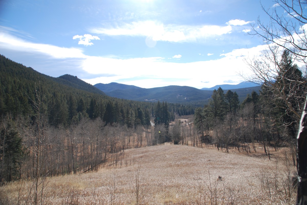
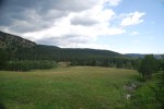
Comments: This is an enjoyable and easy hike with bucolic mountain pastures and stunning mountain vistas. The rain amplified the Ponderosa Pine aroma. It was easy to imagine cows and horses grazing in the mountain meadows. Just stunning.
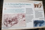
The DeLonde trail is rather easy trail. Narrow in some spots, but not excessively rocky and minimal tree roots. It passes through stands of Ponderosa pines and Aspen. About half of the DeLonde trail is on the old Switzerland (ran from Boulder to Ward) narrow gauge railway line and was quite wide and smooth. A pretty easy hike to the DeLonde homestead.
Read more about the Caribou Ranch recording studio. In the ’70s and ’80s some of the most famous albums in rock history were recorded nearby.
The Bluebird Loop from the DeLonde homestead is initially narrow and rocky. After the mine spur turn off, the trail opens up (likely due to the return to the narrow gauge railway bed) and is very easy to walk on.
Our herd of turtles start cost us during the hike. We got caught in a late morning rainstorm. Alex was a trooper and did about 2.5 miles of the entire hike. But the rain pushed him over the edge. As Jess was piggy backing him out the last 1.5 miles, he sounded like a little gremlin growling.
Caribou Ranch Gallery
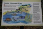
Educational sign – Wetlands and wildlife.
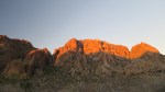
Mountain vistas.
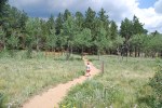
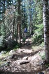
Alex, leading the way at full speed ahead.
Alex leading us around the bend.
A peek at the DeLonde homestead through the trees.
Heading down the lane from the DeLonde homestead from the Switzerland Trail.
Meadows and mountains.
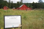
The barn is now housing for an artist in residence (new artist every week).
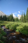
Creek along the Bluebird loop.
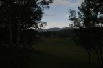
Mountains across the meadow.
Blue skies heading our way.
Wildflower, 1 of 3
Wildflower, 2 of 3.f
Wildflower, 3 of 3
Educational sign – Switzerland Trail of America
Educational sign – the DeLonde homestead.
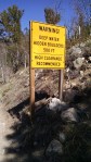
Destination: Aspen Alley, West Magnolia Recreation area
Comments: We last visited Aspen Alley over Mother’s Day. Since our last visit, the Aspens are in full leaf and the clear cut areas were full of wild flowers. This hike we found the right trail through Aspen Alley. We also remembered not to go down 926B, since it was a more difficult hike to get back to the car.
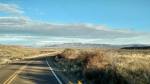
Aspen Alley hiking route.
Aspen Alley Gallery
Storm clouds starting to roll in.
The rain beginning to fall.
Blue skies in the distance.
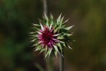
Flowers and insects, 1 of 3. Bee on thistle flower.
Flowers and insects, 2 of 3. Unopened thistle flower, no insect.
Destination: Rainbow Lakes, Roosevelt National Forest
Date: 6/17/2017
Time of Day: 9:15 am start (What you say? No herd of turtles? A yard sale was even attended prior to the hike)
Distance/Elevation/Difficulty: 2.6 miles (total)/~396 feet/Easy
Time Elapsed: 120 minutes.
Comments: This is the second time we attempted this trail. The first time was the weekend of June 10th, when we discovered the road was closed to the trail head when we got to the gate across the road. We didn’t want to add an 8 mile round trip to our hike, so we decided to come back another day. Lesson learned – check this website for road closures ahead of time.
While we got an early start, we didn’t reach the trail head until 10 am. The last 4 miles of road are rough and narrow. Lower clearance cars can make it, but care must be taken to avoid the worst holes.
The trail started out relatively smooth near the Rainbow Lakes Campground (can access trail from campground), but became progressively more rocky at points. Nothing that required climbing on rocks, but careful foot placement would be wise. Trail did not have any steep areas.
This is a heavily trafficked trail and many people bring their dogs. The lake are supposedly well stocked so there are plenty of fishing poles being carried a well. We also heard a report of a moose at the second lake that is on the trail.
While this is a popular and heavily trafficked trail, it is not well marked. After reaching the first lake, we followed the trail until we reached a small snow field in the woods. On one side of the snow was what looked to be a well trafficked trail, and skirting the edge of the trail and going over a ridge was what appeared to be a social trail. We chose the wider trail. We chose poorly. The social trail was the actual trail and the wider, apparently well traveled path led to a dead end of downed trees. There were several other instances on the trail that a careful evaluation had to be done to select the correct way.
Alex was in a hiking mood and hiked the entire trail out and back. A great little trooper. This also explains why it took us so long to do a 2.6 mile hike.
Would we return? Definitely. We hope that we are able to enjoy the entire trail on our third go around. We here the view at the end is rather nice.
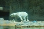
Destination: Denver Zoo, 2300 Steele Street, Denver, CO 80205
Date/Time: June 3, 9:45
Alex loves animals, so we decided to take him to the zoo for his birthday. This trip was a huge success. The Denver Zoo is very family friendly – you can bring your own food and drink (money saver!). Also, lots of families brought their own wagon for pulling the kids and food (we were not that smart, but next time). Unlike our standard herd of turtles approach, we were out of the house early and through the zoo gates at around quarter to ten. An earlier start is wise on beautiful, sunny weekend.
It was ungulate (hooved) animal week at the zoo. This meant that all the hooved animals were highlighted and there were some special activities going on. Like feeding the giraffes leaves! Alex absolutely loved this activity and said thank you to the giraffes when he was finished handing out leaves. Alex was also very excited to see the elephants.
In the North Shore area of the zoo, there is a great kid play area with a sand box and a ‘tidal pool’. Alex enjoyed the tidal pool immensely. It is amazing how wet he got splashing in water that was barely 2 inches deep in spots. We stopped for ice cream afterwards (Alex’s was free – part of the birthday bonus pack) and took off Alex’s pants to dry in the sun while we relaxed. Lots of sunshine and low humidity, his pants were almost dry in 20 minutes.
The zoo also has some great programs through out the day during feedings and show times. Check out the website. We found all the employees and volunteers to be very helpful and enthusiastic. There is also a carousel and train, but we are saving that fun for a future visit.
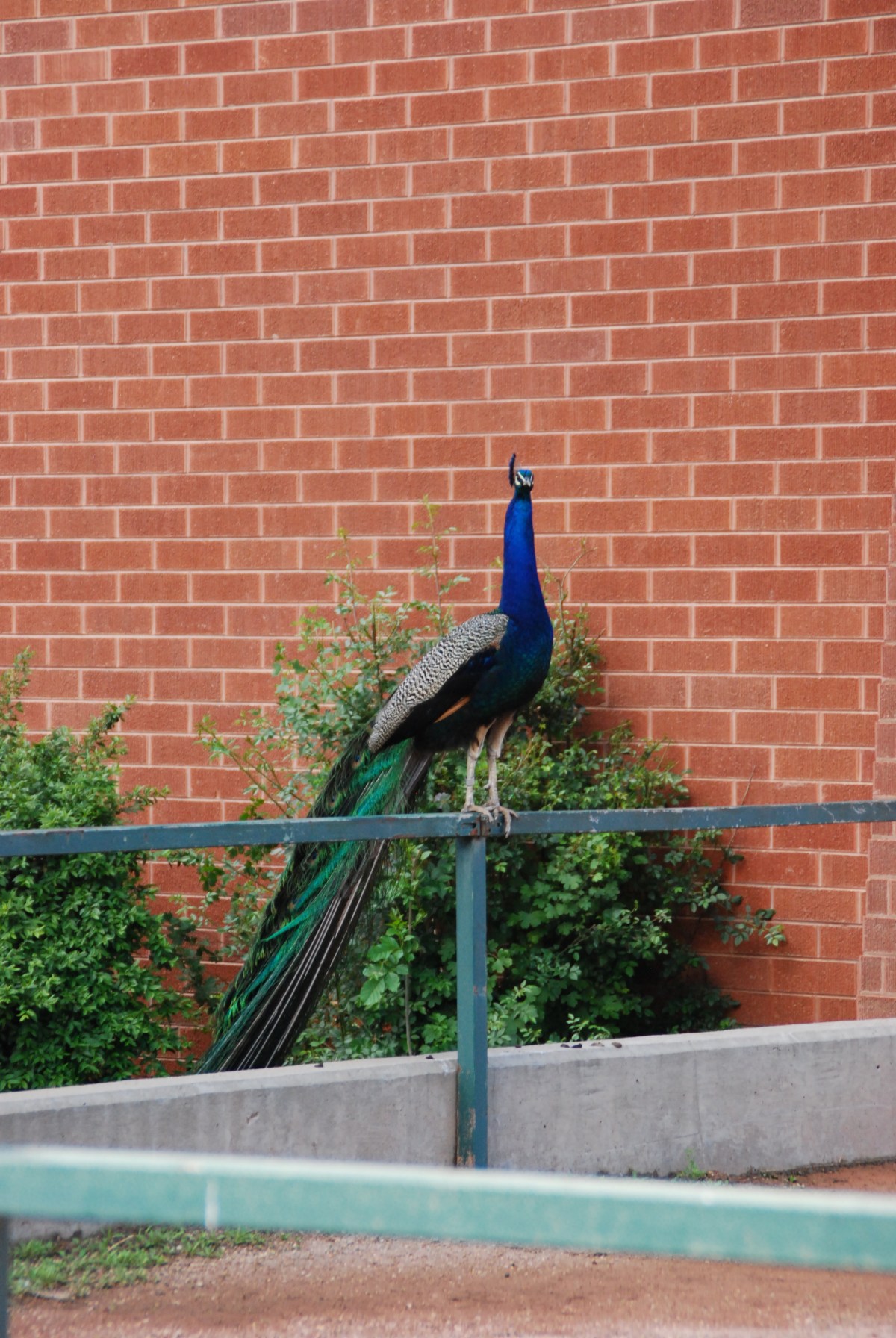
Peacocks, peahens, and geese roam freely on the zoo grounds. Be prepared to have a goose stare intently at you for food (don’t feed them) or witness a goose fight. The fuzzy goslings were adorable. Keeping Alex from chasing after the birds was challenging initially, but he quickly learned that walking near the birds was okay.
Fun fact: Giraffes have very long tongues (think foot plus) that they can wrap around objects they want to grip.
Gallery
Alex watching the peahens
Peacock wandering the grounds. They have their own security team to keep them in the zoo boundaries
Time of Day: 10:30 am start. Herd of turtles again
Distance/Elevation/Difficulty: 1.9 miles (Tungsten and Kinnickinnick loops)/~300 feet/Easy
Time Elapsed: 90 minutes.
Trail map of Mud Lake
Comments: We could hike to Mud Lake from our house, but we didn’t want to add 1.2 miles through the spring snow to our hike. So we drove. We also remembered our YakTrax so walking on the packed snow was easier. The YakTrax worked well, but there were challenges with keeping them on our shoes. Snow would build up between the Trax and our shoes, dislodging the Trax. Alex did a great job in the snow and walked approximately a half mile before asking to be put in the Osprey.
During our hike, a couple of other hikers told us about a moose that was just off the trail. Unfortunately, the moose was gone by the time we arrived, as evidence in the tracks in the snow. Alex was disappointed but seemed to accept the explanation that ‘Mister Moose’ had to go home for lunch.
Part of the Tungsten loop borders Mud Lake Proper where we saw a beaver. Walking on, we saw a male and female duck pair (mallards, teals? They didn’t quack, but we are certain they were ducks of some sort) diving for food in the lake. Alex got a good giggle over the duck butts up in the air. Not a moose, but not a bad consolation prize.
Would we return? This is a great hike. Easy for the days where we don’t want to over exert our selves. Another advantage is the easy access from the house. Dave and Alex will be returning here for 9 weeks during the summer to participate in the Wild Bear Nature Center summer camp program.
Gallery
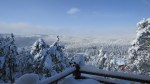
View of the ~30 inches of snow that fell from Wednesday through Thursday.
In 48 hours we will hike through what is left of our snowy bounty.
Not a bad place to sit and reflect.
A view to reflect on
More mountains
And still more mountains.
Mountain views across Mud Lake.
Really is a beaver in this picture. We saw it move.
Comments: This area is known for encampments of homeless people. The summer weather is moderate and significant numbers of homeless people set up summer camps in this area. We didn’t see any camps on this hike.
Purple is the route we hiked out, orange is the route we hiked back.
We didn’t do the hike as listed on AllTrails. The route followed is shown below. The All Trails route includes the 342 loop around the clear cut area and 925. Coming back down 925B resulted in some slightly steeper and rockier terrain. We also ended up below the parking area and had to hike back up.
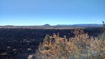
This area has some areas that were clear cut 3-5 years ago. This takes away from the scenic aspects of the hike while opening up some mountain vistas.
Would we return? This would be a beautiful hike in the fall after the aspens change color. There were some very nice aspen stands along the hike. There is a large number of trails in this area and overall this was an easy hike for when we want to get outdoors but not over exert ourselves.
Destination: Lost Lake in the Indian Peaks Wilderness
Date: 5/6/2017
Time of Day: 10 am start. This time reflects when we arrived, parked, got Alex loaded into his Osprey, and started walking towards the trail head. We are like a herd of turtles some days, and it was one of those days. This is a popular trail head on a beautiful spring day. We were parked in the designated parking area and were not forced to park in Eldora.
Distance/Elevation: 4.2 miles/931 feet
Time Elapsed: 3.5 – 4 hours. We did not hike around the lake, but this time includes Alex splashing in mud along the lake shore.
Comments: A beautiful hike. While there was a good amount of traffic, everyone was polite and all dogs encountered were leashed and well behaved. Upper half of trail was slippery with snow pack and we wished we had our YakTrax. Lesson learned for spring hiking. The Hessie trail head was about a 10 minute walk from the parking area, if the water level had been lower at a couple points, we would have attempted to drive to the trail head (2017 Subaru Outback).
Would we return? Definitely. There are campsites along the lake, we would like to hike up and go tent camping later in the summer. This would allow us to hike some of the other trails in the area.
Gallery
If it hadn’t been for the deep water hiding the boulders, we might have tried taking the Subaru to the Hessie trailhead.
No better way to start the new year than to reminisce about 2016 and plan a trip (or two) for 2017.
Some quick stats for 2016
Miles traveled in Abby: ~ 13,800
Time spent in Abby: ~12 weeks
Longest stretch of time in Abby: ~ 4 weeks
National Parks/Monuments visited: 18
State Parks visited: 13
BLM lands camped on: 8
Private campground: 6
Family members/friends imposed on: 6
Canadian Provinces visited: 2
States visited: 22
Home brews: 12
Home brews dumped: 1
New pieces of brewing equipment purchased: 2
Looking back 2016 was a chaotic year. We didn’t travel in California as much as we had hoped when we were living there. Our move to Colorado involved two too many visits to emergency rooms. We didn’t spend as much time in any one of many amazing locations as we would have liked. But we had a lot of fun and saw some truly amazing sights. We’ve watched Alex grow and develop an enjoyment of the outdoors.
Our 2017 RV travel schedule is complicated by the fact that Jess is now employed. The copious free time of unemployment has vanished. We also need to consider visits with family so Alex can continue to develop a close relationship with his Mimi and Papa and uncles and aunts and cousins. We also hope to change our trips slightly. Instead of the wheels are always rollin’ mentality where we average 250 miles of driving per day of a trip, we want to focus on a deeper exploration of an area.
This means we will have to stop using a shoe horn to add destinations into our itinerary that are *only* 150 miles away. We will have to leave some amazing destinations off our list, for a future trip (or when we win the lottery).
And to add to the list, we found a house that we liked and are in the final stages of the purchasing process. Remodeling fun also awaits us in 2017 (and 2018 and 2019).
2016 Gallery
Okay, this is technically 2015, but it is the day we left upstate NY. It is the start of our 2016 adventure.
Alex hanging out in Quartzite , AZ.
Some of the rigs seen at Quartzite.
Heading south to Big Bend.
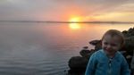
Big Bend sunset.
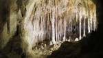
Cavern pool.
Speleotherm formation.
Being forced into manual labor to pay for the room and board at the house of friends.
Happiness is running through a puddle.
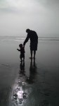
Alex and Dave on the beach in Santa Cruz.
New brew equipment!
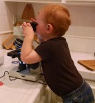
A future microbiologist (?) taking a his first look through a microscope.
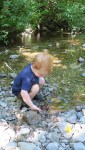
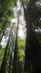
Alex enjoying the rocks in Mill Creek.
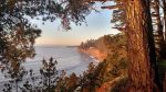
View from Patrick’s Point towards Wedding Rock.
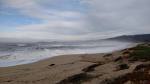
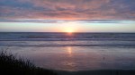
View after sunset as the fog rolls in at Westport Union Landing State Beach.
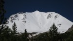
Mount Lassen with a fresh coat of snow.
Great Basin.
Great Basin.
A wild boy at Great Basin
Quote from Black Elk at Little Bighorn Battlefield National Monument.
Sculpture at the Native American Memorial.
Markers indicating where Native American warriors fell during battle.
Markers indicating where US Calvary members fell. The black marker is George Custer’s. Three other Custer family members died in that battle, as well.
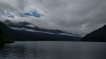
View of Two Medicine Lake.
Hike around Two Medine.
Two Medicine Lake.
Lake McDonald
Going to the Sun Road
Going to the Sun Road
Jackson Glacier
Lava Beds in the morning.
Oregon Coast.
Jess, Alex, and the dogs enjoying a frolic on a Oregon beach.
Lighthouse at Cape Disappointment in Washington.
Jess chasing Alex down the beach in Washington.
Driftwood shelter at Cape Disappointment, Washington.
Wizard Island from a bit further out on the bluff.