Distance/Elevation/Difficulty: 2.0 miles (one way)/+971/Most difficult
Time Elapsed: 120 minutes.
Comments: This is our first visit to Golden Gate Canyon State Park. We came in off of Gap Road, and it would have been better to come in at the visitors center for our inaugural visit. We found our way to Mountain Base road and stopped in Bootleg bottom (named for the bootleggers that used to operate out of the area). We decided to try the Coyote Trail since we conveniently parked at the trail head.
The trail starts out deceptively simple. A smooth trail along side some mountain meadows lined with Aspen. Soon the trail heads into the woods and the difficulty increases to moderate – it is rockier but nothing to strenuous. Then the difficulty increases again, with a scramble up some rocks where care must be taken. Unfortunately, weather started to blow in and we were not prepared for hiking in freezing rain/snow. Or going back down a wet rock scramble while packing Alex. We opted to turn back for safety reasons and did not make it to Frazer meadow.
Would we return? Definitely. We really enjoyed our abbreviated hike. We look forward to coming back with an earlier start.
Gallery
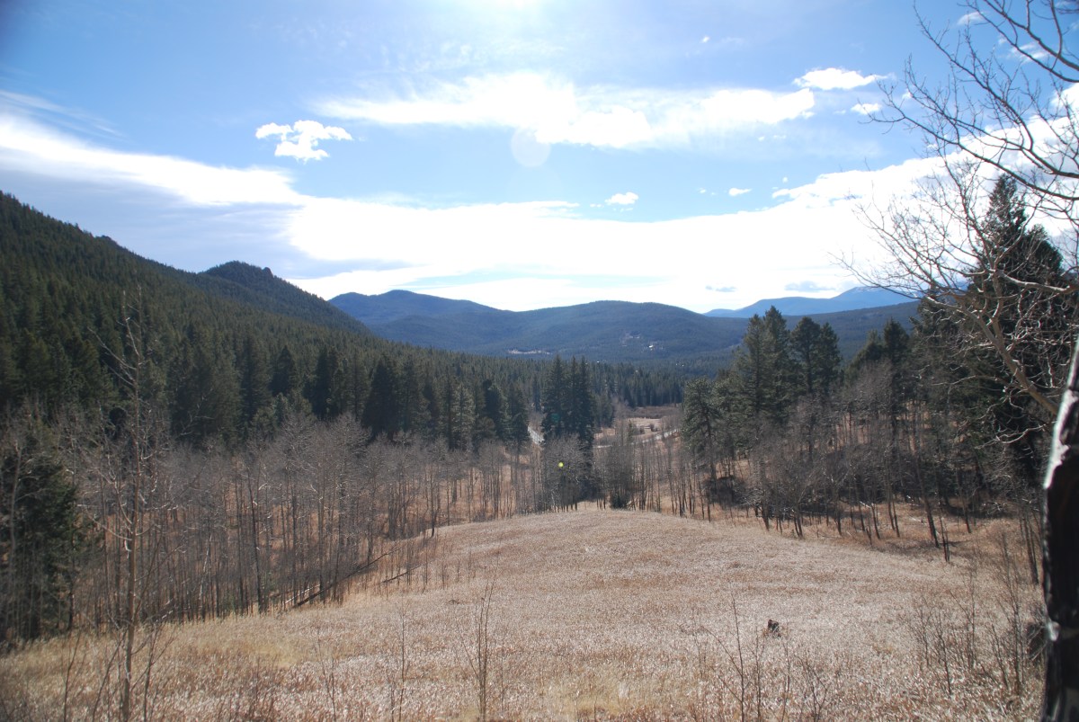
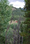
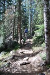
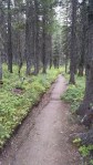
Starting out on the coyote trail. We think we’ll be headed up that way.
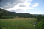
The meadow at the beginning of the trail
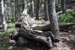
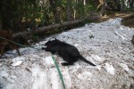
Alex investigating the remains of a bootlegger’s car.
Historical sign by cabin (not pictured).
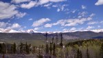
View from the rock scramble. The weather is coming in.
Distance/Elevation/Difficulty: 4.3 miles (total)/~180 feet/Easy
Time Elapsed: 180 minutes.
Comments: This was a beautiful hike that was even more enjoyable since we were hiking with friends. Based on their advice, we arrived at 9 am in the Brainard Lake parking lot. The Long Lake lot was already full and the ranger said a 6 – 6:30 am arrival was needed to ensure a spot in the Long Lake lot! This is not happening with Alex. Starting at the Brainard Lake lot added 1.5 miles round trip to our 2.8 mile hike, so be prepared to for a longer walk. The Long Lake Loop is also known as the Jean Lunning Loop.
Alex did great and hiked approximately 3.5 miles (out to the trail, the trail, and was carried from the trail head to the parking lot). In general, the trail is smooth and wide. There are some wooden bridges above swampy sections, but they are very sturdy. Leashed dogs are welcome and all pups we encountered were very well behaved. Alex dipped his toes in the lake and confirmed it was cold. Despite the chilly, he had a great time wading in the lake.
Would we return? Definitely. The road up to the recreation area is good and there is a campground. We hope to bring Abby up soon for a long weekend so we can get an early start and go on longer day hikes. Another option we look forward to is taking a picnic to Brainard Lake – no hiking, just Alex splashing in the water.
Gallery
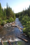
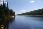
Outflow of Brainard Lake.
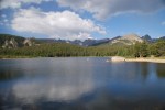
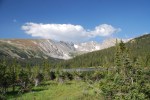
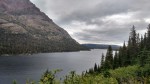
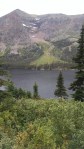
View of Long Lake and Niwot Ridge.
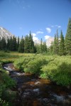
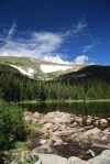
South St. Vrain Creek with Apache Peak (13,441 ft) and Shoshoni Peak (12,967 ft).
Destination: Rainbow Lakes, Roosevelt National Forest
Date: 8/13/2017
Time of Day: 9:45 am start
Distance/Elevation/Difficulty: 2.6 miles (total)/~396 feet/Easy
Time Elapsed: 180 minutes.
Comments: This is the second time we hiked (or tried to hike this trail). Our first hike was almost two months ago, the first weekend that the trails and campground was open. It was a madhouse. This weekend was much quieter: we were able to get a parking spot in the trail head lot, campground was not full, and there were fewer people dispersed camping along the road to the trail head.
We were actually hiking at 9:45. Out of the house by 9:15 and the road was much improved compared to two months ago. It seems like gravel was brought in and a road grader touch the surface to help reduce the bone rattling drive. We would actually think about bringing Abby up the road (if poor Abby was in running condition).
As with our first trip, the trail is still poorly marked and the multitude of social trails just add to the challenge. Following the trail was easier this time with the snow fields melted away and down trees cleared. We clearly saw where we lost the trail on our first hike and where the trail went. It is no wonder we lost it, two months ago it was covered with snow. With the snow gone it was little more than a goat path through some rocks.
As the trail heads down to the second lake, there is an option to take the second switch back and go to the lake shore, or continue on straight towards the third and fourth lakes. The distance between lake 1 and 2 is very close, it is a longer hike from lake 2 to 3, and lakes 3 and 4 are adjacent. There is a fifth lake close to lake 4, but we did not pick out the trail to head that way.
While we were dipping our toes in the frigid water of lake 2, fellow hikers shared the report of a moose sighting in lake 4. Alex, who desperately wants to see a moose, led the way. Unfortunately, we arrived at the lake after Mr. Moose had gone home to take a nap. According to Alex, Mr. Moose is a fan of Thomas the Train and was going to watch Thomas after his nap.
Alex was in a hiking mood and hiked the entire trail out and back. A great little trooper. This took us 3 hours to do the full loop (and we foolishly though we walked close to 2.6 miles the first time. Ha!). Considering the size of rocks Alex had to clamber over and that we stopped to dip our toes in a frigid lake, 3 hours was a good pace.
Ah, college kids: About 1/10 of a mile shy of the trail head, we saw a group of college kids heading up to the lakes to fish. One kid carrying a half dozen poles, another kid with a bucket, a couple kids carrying food/camp chairs, and the two poor souls at the end lugging up a cooler. Filled with ice (and beers?)? These poor souls thought the lake (and only one lake) was much closer to the parking lot than the 3/4 of a mile they had in front of them.
Other observations: Mushroom hunters! We saw several people carrying buckets and looking for mushrooms. When asked, one person said that it wasn’t the most successful forage she has ever done.
Would we return? Definitely. It was so much easier the second time around without the snow on the ground. It would be nice to find the fifth lake and perhaps see the moose. One should note, that these are small ‘lakes’ (ponds really). So if expectations are along the size of the Great Lakes, disappointment will abound.
Gallery
Map of Indian Peaks Wilderness at the Rainbow Lakes/Arapaho Glacier trail head.
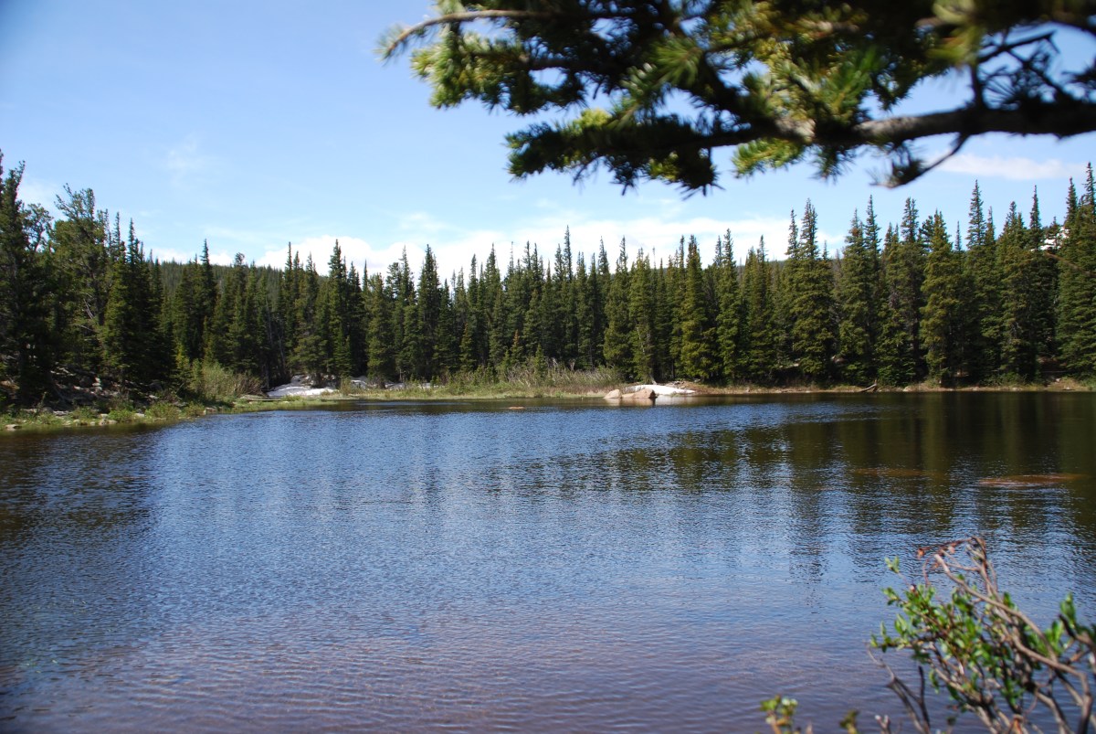
Moon over the mountains at lake 1.
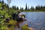
Dipping our feet in the very cold water of lake 2.
Alex wanted to dip his toes in further.
Rock field.
Lake 4.
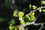
A very hardy flowering bush growing from between the rocks.
We actually extracted ourselves from the deck project and went hiking – Saturday and Sunday this week!
Destination: Caribou Ranch, Boulder County Open Space
Date: 7/21/2017
Time of Day: 10:30 am start
Distance/Elevation/Difficulty: 4.2 miles (DeLonde out and back + Bluebird loop)/~340 feet/Easy (DeLonde) & Moderate (Bluebird)
Time Elapsed: 120 minutes.
Comments: This is an enjoyable and easy hike with bucolic mountain pastures and stunning mountain vistas. The rain amplified the Ponderosa Pine aroma. It was easy to imagine cows and horses grazing in the mountain meadows. Just stunning.
The DeLonde trail is rather easy trail. Narrow in some spots, but not excessively rocky and minimal tree roots. It passes through stands of Ponderosa pines and Aspen. About half of the DeLonde trail is on the old Switzerland (ran from Boulder to Ward) narrow gauge railway line and was quite wide and smooth. A pretty easy hike to the DeLonde homestead.
Read more about the Caribou Ranch recording studio. In the ’70s and ’80s some of the most famous albums in rock history were recorded nearby.
The Bluebird Loop from the DeLonde homestead is initially narrow and rocky. After the mine spur turn off, the trail opens up (likely due to the return to the narrow gauge railway bed) and is very easy to walk on.
Our herd of turtles start cost us during the hike. We got caught in a late morning rainstorm. Alex was a trooper and did about 2.5 miles of the entire hike. But the rain pushed him over the edge. As Jess was piggy backing him out the last 1.5 miles, he sounded like a little gremlin growling.
Caribou Ranch Gallery
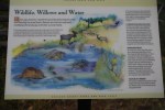
Educational sign – Wetlands and wildlife.
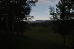
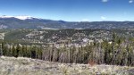
Mountain vistas.
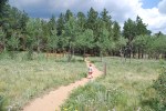
Alex, leading the way at full speed ahead.
Alex leading us around the bend.
A peek at the DeLonde homestead through the trees.
Heading down the lane from the DeLonde homestead from the Switzerland Trail.
Meadows and mountains.
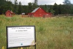
The barn is now housing for an artist in residence (new artist every week).
Creek along the Bluebird loop.
Mountains across the meadow.
Blue skies heading our way.
Wildflower, 1 of 3
Wildflower, 2 of 3.f
Wildflower, 3 of 3
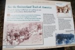
Educational sign – Switzerland Trail of America
Educational sign – the DeLonde homestead.
Destination: Aspen Alley, West Magnolia Recreation area
Comments: We last visited Aspen Alley over Mother’s Day. Since our last visit, the Aspens are in full leaf and the clear cut areas were full of wild flowers. This hike we found the right trail through Aspen Alley. We also remembered not to go down 926B, since it was a more difficult hike to get back to the car.
Aspen Alley hiking route.
Aspen Alley Gallery
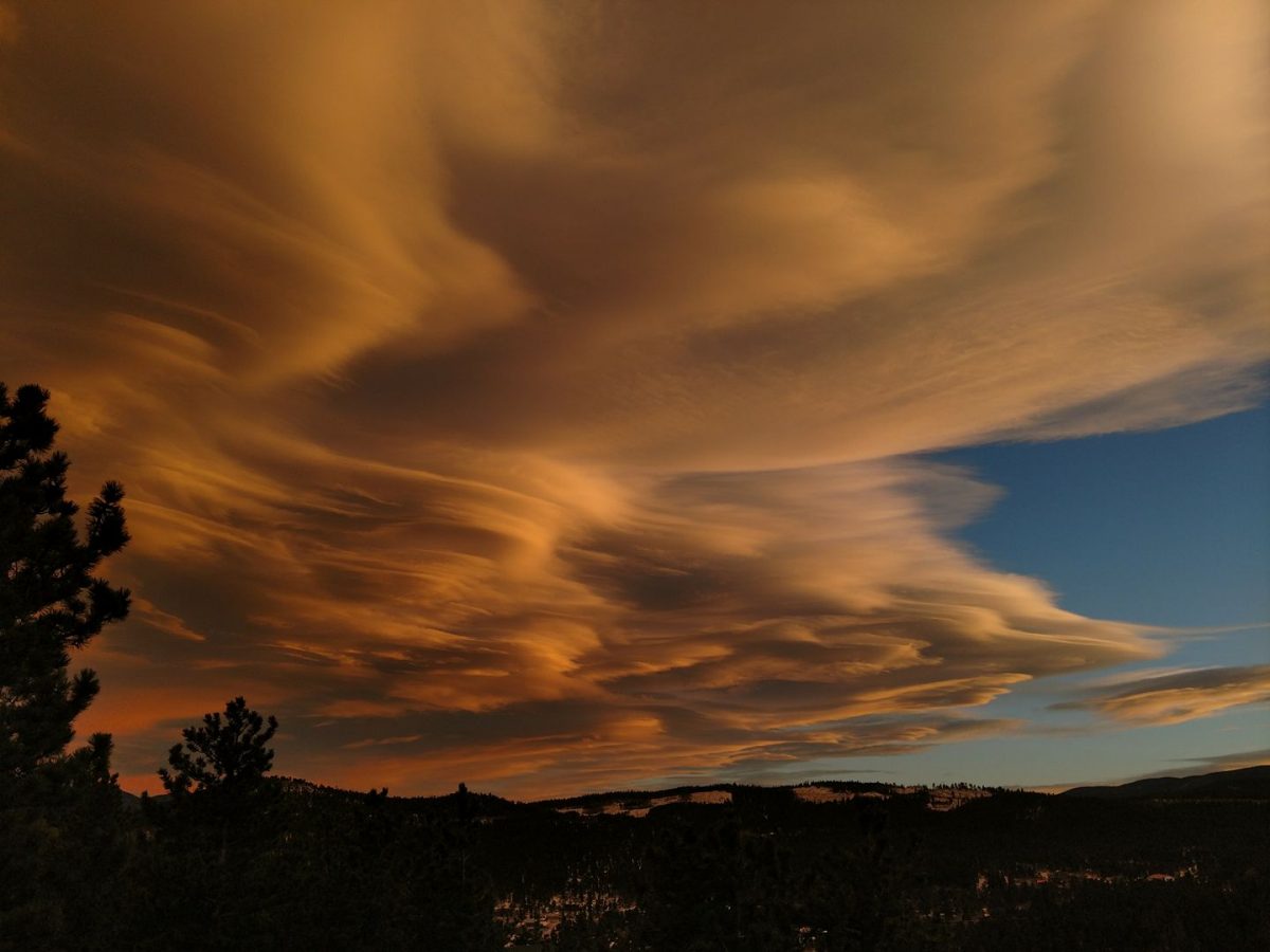
Storm clouds starting to roll in.
The rain beginning to fall.
Blue skies in the distance.
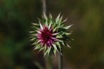
Flowers and insects, 1 of 3. Bee on thistle flower.
Flowers and insects, 2 of 3. Unopened thistle flower, no insect.
Destination: Rainbow Lakes, Roosevelt National Forest
Date: 6/17/2017
Time of Day: 9:15 am start (What you say? No herd of turtles? A yard sale was even attended prior to the hike)
Distance/Elevation/Difficulty: 2.6 miles (total)/~396 feet/Easy
Time Elapsed: 120 minutes.
Comments: This is the second time we attempted this trail. The first time was the weekend of June 10th, when we discovered the road was closed to the trail head when we got to the gate across the road. We didn’t want to add an 8 mile round trip to our hike, so we decided to come back another day. Lesson learned – check this website for road closures ahead of time.
While we got an early start, we didn’t reach the trail head until 10 am. The last 4 miles of road are rough and narrow. Lower clearance cars can make it, but care must be taken to avoid the worst holes.
The trail started out relatively smooth near the Rainbow Lakes Campground (can access trail from campground), but became progressively more rocky at points. Nothing that required climbing on rocks, but careful foot placement would be wise. Trail did not have any steep areas.
This is a heavily trafficked trail and many people bring their dogs. The lake are supposedly well stocked so there are plenty of fishing poles being carried a well. We also heard a report of a moose at the second lake that is on the trail.
While this is a popular and heavily trafficked trail, it is not well marked. After reaching the first lake, we followed the trail until we reached a small snow field in the woods. On one side of the snow was what looked to be a well trafficked trail, and skirting the edge of the trail and going over a ridge was what appeared to be a social trail. We chose the wider trail. We chose poorly. The social trail was the actual trail and the wider, apparently well traveled path led to a dead end of downed trees. There were several other instances on the trail that a careful evaluation had to be done to select the correct way.
Alex was in a hiking mood and hiked the entire trail out and back. A great little trooper. This also explains why it took us so long to do a 2.6 mile hike.
Would we return? Definitely. We hope that we are able to enjoy the entire trail on our third go around. We here the view at the end is rather nice.
Comments: This area is known for encampments of homeless people. The summer weather is moderate and significant numbers of homeless people set up summer camps in this area. We didn’t see any camps on this hike.
Purple is the route we hiked out, orange is the route we hiked back.
We didn’t do the hike as listed on AllTrails. The route followed is shown below. The All Trails route includes the 342 loop around the clear cut area and 925. Coming back down 925B resulted in some slightly steeper and rockier terrain. We also ended up below the parking area and had to hike back up.
This area has some areas that were clear cut 3-5 years ago. This takes away from the scenic aspects of the hike while opening up some mountain vistas.
Would we return? This would be a beautiful hike in the fall after the aspens change color. There were some very nice aspen stands along the hike. There is a large number of trails in this area and overall this was an easy hike for when we want to get outdoors but not over exert ourselves.
We enjoyed our hike around Two Medicine Lake, which was approximately 8 miles. If we had gotten an earlier start, we would have tried to make No Name Lake – there were reports of a moose spending the afternoon in the water. There was a boat that we could have taken from the General Store to the west end of the lake. This would have allowed us to hike trails up to the lakes, perhaps even Dawson pass.
The route we took resulted in a more gradual climb up to along the southeast side of the lake. The trail on the northwest side of the lake is not close to the water as one might think. It is actually up the mountain.
Click on the images in the gallery below to start slide show.
Day 11 is truly a westward ho day! On the way to Big Bend National Park we end up over 250 miles west of our starting location. We have beautiful weather for traveling and lots of long, straight, Texas road. The road is good, except for a few unmarked ‘dips’ on US-385S that are reminiscent of a roller coaster.
On the way, we stop at the Wal-Mart in Fort Stockton for a resupply. Normally, this is not our first choice in shopping, but there are certain brands we know that we can get at a national chain. The Fort Stockton store has to be on of the saddest stores we have seen. A woman tried to sell us a puppy on the way into the store. Selections are limited and the beer is primarily two types, Bud and Bud Lite. We are thrilled to find Shiner Bock tucked away at the end of the refrigerated case. RV restocked, we turn south.
A bend in US-285S gives us a preview of the mountains we are heading towards.
We are camping in the Chisos Basin campground at Big Bend National Park. The basin is in the Chisos Mountains, the only mountain range in the United States entirely within the confines of a national park. The mountains are significantly cooler and receive, on average, over twice the annual rainfall than surrounding Chihuahuan Desert. The flora and fauna found in the mountains were stranded when the great ice age ended and reflect a cooler, moister climate. An example of an animal unique to the Chisos is the Carmen Mountain white-tailed deer, which are not well adapted to deserts. The mountain lion (local name: panther) is also present in the mountains. The Chisos are the only nesting area for the Colima warbler, which winters in Mexico. The Arizona pine, Douglas fir, Arizona cypress, quaking aspen, and big-tooth maple are trees that are ice-age remnants.
Abby squeezed into spot 43.
Abby acquits herself well on the climb from the desert into the Chisos Mountains. As we descend into the basin to camp, we get to experience the switchbacks and the hills we will have to climb in a couple of days. It has been a long trip, and experience has caused us to have some paranoia regarding taxing Abby’s transmission. We arrive to find a full campground and are glad we have reservations. It is winter break for colleges and this is a popular destination for the young whippersnappers. We are a tight fit in site 43, but manage to snug our rig in.
With Alex tucked away into bed, we enjoy the night sky. Big Bend was named an international dark-sky park by the International Dark-Sky Association in 2012. The park is also recognized as having the darkest measured skies in the lower 48 states. What does this mean? Simply put, we have never seen so many stars. It was difficult to pick out Orion because it was easy to lose the constellation among the thousands of stars. We see the Milky Way, not as a band, but of light and dark blotches. It is truly breath-taking. We do not get any pictures that do the sky justice.
Our rig attracts the attention of a park ranger on our first night, but after hearing we are staying only two nights, he decides to move on. We feel relief that we don’t have to pack up and move at that very instant (10 pm).
Abby in our new site.
The next morning Dave chats with the campground host and finds out that site 35, the old host site is not occupied that night. To avoid attracting the attention of a less tolerant ranger, we pull the slide in and quickly hop campsites. This site much more spacious (we are able to use the our awning), but is first come, first serve site.
View of the ‘Window’ from the Chisos Basin loop trail.
Chisos Basin continues to impress and we are very sorry to have only a full day here. There are great hiking trails and the park brochure provides excellent details regarding the difficulty of each trail. Due to time constraints, we only able to hike the Chisos Basin loop, with a slight detour on the Laguna Meadows trail. We will be more careful to read trail signs and consult with our trail map in the future.
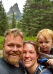
Family photo with the ‘Window’ as our background.Alex in his Osprey carrier.
This is also our first hike with Alex in the Osprey Poco Plus carrier and he loved it. The carrier positions Alex so he is able to see over his human pack mule’s head and he is more engaged with us and our surroundings. The pack mules found the pack to be comfortable, easy to adjust, and is easy to load and secure Alex.
Alex had fun in the campground climbing on rocks and following a road runner as it made its way through the campground. The roadrunner wasn’t sure what to think of his human shadow. Alex also made friends with a group of young men. Friends from a Houston high school, they had all gone to different colleges and were spending the weekend camping together. They let Alex join them in there game of Frisbee and Alex proved adept at taking a the football hand-off and running with the ball.
We plan on coming back. Our future trip will be scheduled with a date range of late January to early March in mind. This time frame will bring warmer weather and the spring wildflowers. We are also planning to come back in Abby sans the cargo trailer. Shortened to 24 feet,we will have our pick of spots.


 Alex had fun in the campground climbing on rocks and following a road runner as it made its way through the campground. The roadrunner wasn’t sure what to think of his human shadow. Alex also made friends with a group of young men. Friends from a Houston high school, they had all gone to different colleges and were spending the weekend camping together. They let Alex join them in there game of Frisbee and Alex proved adept at taking a the football hand-off and running with the ball.
