Distance/Elevation/Difficulty: 2.0 miles (one way)/+971/Most difficult
Time Elapsed: 120 minutes.
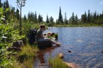
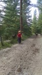
Comments: This is our first visit to Golden Gate Canyon State Park. We came in off of Gap Road, and it would have been better to come in at the visitors center for our inaugural visit. We found our way to Mountain Base road and stopped in Bootleg bottom (named for the bootleggers that used to operate out of the area). We decided to try the Coyote Trail since we conveniently parked at the trail head.
The trail starts out deceptively simple. A smooth trail along side some mountain meadows lined with Aspen. Soon the trail heads into the woods and the difficulty increases to moderate – it is rockier but nothing to strenuous. Then the difficulty increases again, with a scramble up some rocks where care must be taken. Unfortunately, weather started to blow in and we were not prepared for hiking in freezing rain/snow. Or going back down a wet rock scramble while packing Alex. We opted to turn back for safety reasons and did not make it to Frazer meadow.
Would we return? Definitely. We really enjoyed our abbreviated hike. We look forward to coming back with an earlier start.
Gallery
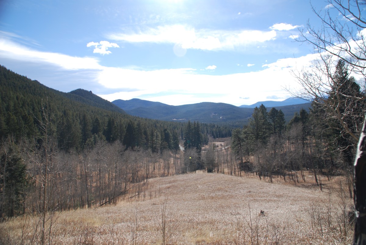
Starting out on the coyote trail. We think we’ll be headed up that way.
The meadow at the beginning of the trail
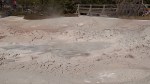
Alex investigating the remains of a bootlegger’s car.
Historical sign by cabin (not pictured).
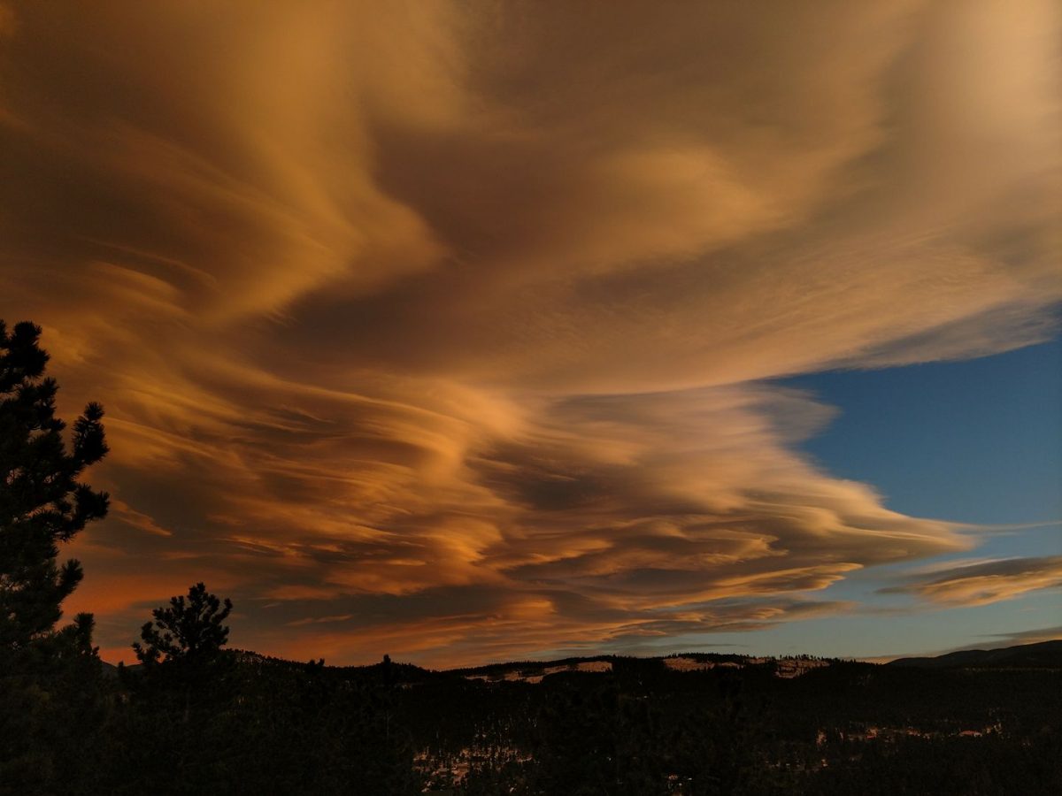
View from the rock scramble. The weather is coming in.
Distance/Elevation/Difficulty: 4.3 miles (total)/~180 feet/Easy
Time Elapsed: 180 minutes.
Comments: This was a beautiful hike that was even more enjoyable since we were hiking with friends. Based on their advice, we arrived at 9 am in the Brainard Lake parking lot. The Long Lake lot was already full and the ranger said a 6 – 6:30 am arrival was needed to ensure a spot in the Long Lake lot! This is not happening with Alex. Starting at the Brainard Lake lot added 1.5 miles round trip to our 2.8 mile hike, so be prepared to for a longer walk. The Long Lake Loop is also known as the Jean Lunning Loop.
Alex did great and hiked approximately 3.5 miles (out to the trail, the trail, and was carried from the trail head to the parking lot). In general, the trail is smooth and wide. There are some wooden bridges above swampy sections, but they are very sturdy. Leashed dogs are welcome and all pups we encountered were very well behaved. Alex dipped his toes in the lake and confirmed it was cold. Despite the chilly, he had a great time wading in the lake.
Would we return? Definitely. The road up to the recreation area is good and there is a campground. We hope to bring Abby up soon for a long weekend so we can get an early start and go on longer day hikes. Another option we look forward to is taking a picnic to Brainard Lake – no hiking, just Alex splashing in the water.
Gallery
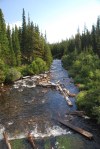
Outflow of Brainard Lake.
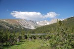
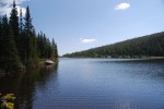
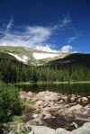
View of Long Lake and Niwot Ridge.
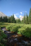
South St. Vrain Creek with Apache Peak (13,441 ft) and Shoshoni Peak (12,967 ft).
Destination: Rainbow Lakes, Roosevelt National Forest
Date: 8/13/2017
Time of Day: 9:45 am start
Distance/Elevation/Difficulty: 2.6 miles (total)/~396 feet/Easy
Time Elapsed: 180 minutes.
Comments: This is the second time we hiked (or tried to hike this trail). Our first hike was almost two months ago, the first weekend that the trails and campground was open. It was a madhouse. This weekend was much quieter: we were able to get a parking spot in the trail head lot, campground was not full, and there were fewer people dispersed camping along the road to the trail head.
We were actually hiking at 9:45. Out of the house by 9:15 and the road was much improved compared to two months ago. It seems like gravel was brought in and a road grader touch the surface to help reduce the bone rattling drive. We would actually think about bringing Abby up the road (if poor Abby was in running condition).
As with our first trip, the trail is still poorly marked and the multitude of social trails just add to the challenge. Following the trail was easier this time with the snow fields melted away and down trees cleared. We clearly saw where we lost the trail on our first hike and where the trail went. It is no wonder we lost it, two months ago it was covered with snow. With the snow gone it was little more than a goat path through some rocks.
As the trail heads down to the second lake, there is an option to take the second switch back and go to the lake shore, or continue on straight towards the third and fourth lakes. The distance between lake 1 and 2 is very close, it is a longer hike from lake 2 to 3, and lakes 3 and 4 are adjacent. There is a fifth lake close to lake 4, but we did not pick out the trail to head that way.
While we were dipping our toes in the frigid water of lake 2, fellow hikers shared the report of a moose sighting in lake 4. Alex, who desperately wants to see a moose, led the way. Unfortunately, we arrived at the lake after Mr. Moose had gone home to take a nap. According to Alex, Mr. Moose is a fan of Thomas the Train and was going to watch Thomas after his nap.
Alex was in a hiking mood and hiked the entire trail out and back. A great little trooper. This took us 3 hours to do the full loop (and we foolishly though we walked close to 2.6 miles the first time. Ha!). Considering the size of rocks Alex had to clamber over and that we stopped to dip our toes in a frigid lake, 3 hours was a good pace.
Ah, college kids: About 1/10 of a mile shy of the trail head, we saw a group of college kids heading up to the lakes to fish. One kid carrying a half dozen poles, another kid with a bucket, a couple kids carrying food/camp chairs, and the two poor souls at the end lugging up a cooler. Filled with ice (and beers?)? These poor souls thought the lake (and only one lake) was much closer to the parking lot than the 3/4 of a mile they had in front of them.
Other observations: Mushroom hunters! We saw several people carrying buckets and looking for mushrooms. When asked, one person said that it wasn’t the most successful forage she has ever done.
Would we return? Definitely. It was so much easier the second time around without the snow on the ground. It would be nice to find the fifth lake and perhaps see the moose. One should note, that these are small ‘lakes’ (ponds really). So if expectations are along the size of the Great Lakes, disappointment will abound.
Gallery
Map of Indian Peaks Wilderness at the Rainbow Lakes/Arapaho Glacier trail head.
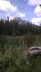
Moon over the mountains at lake 1.
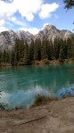
Dipping our feet in the very cold water of lake 2.
Alex wanted to dip his toes in further.
Rock field.
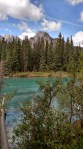
Lake 4.
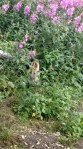
A very hardy flowering bush growing from between the rocks.
Time of Day: 10:30 am start. Herd of turtles again
Distance/Elevation/Difficulty: 1.9 miles (Tungsten and Kinnickinnick loops)/~300 feet/Easy
Time Elapsed: 90 minutes.
Trail map of Mud Lake
Comments: We could hike to Mud Lake from our house, but we didn’t want to add 1.2 miles through the spring snow to our hike. So we drove. We also remembered our YakTrax so walking on the packed snow was easier. The YakTrax worked well, but there were challenges with keeping them on our shoes. Snow would build up between the Trax and our shoes, dislodging the Trax. Alex did a great job in the snow and walked approximately a half mile before asking to be put in the Osprey.
During our hike, a couple of other hikers told us about a moose that was just off the trail. Unfortunately, the moose was gone by the time we arrived, as evidence in the tracks in the snow. Alex was disappointed but seemed to accept the explanation that ‘Mister Moose’ had to go home for lunch.
Part of the Tungsten loop borders Mud Lake Proper where we saw a beaver. Walking on, we saw a male and female duck pair (mallards, teals? They didn’t quack, but we are certain they were ducks of some sort) diving for food in the lake. Alex got a good giggle over the duck butts up in the air. Not a moose, but not a bad consolation prize.
Would we return? This is a great hike. Easy for the days where we don’t want to over exert our selves. Another advantage is the easy access from the house. Dave and Alex will be returning here for 9 weeks during the summer to participate in the Wild Bear Nature Center summer camp program.
Gallery
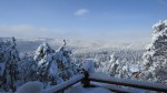
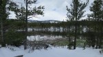
View of the ~30 inches of snow that fell from Wednesday through Thursday.
In 48 hours we will hike through what is left of our snowy bounty.
Not a bad place to sit and reflect.
A view to reflect on
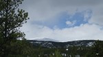
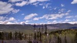
More mountains
And still more mountains.
Mountain views across Mud Lake.
Really is a beaver in this picture. We saw it move.
Comments: This area is known for encampments of homeless people. The summer weather is moderate and significant numbers of homeless people set up summer camps in this area. We didn’t see any camps on this hike.
Purple is the route we hiked out, orange is the route we hiked back.
We didn’t do the hike as listed on AllTrails. The route followed is shown below. The All Trails route includes the 342 loop around the clear cut area and 925. Coming back down 925B resulted in some slightly steeper and rockier terrain. We also ended up below the parking area and had to hike back up.
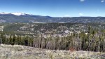
This area has some areas that were clear cut 3-5 years ago. This takes away from the scenic aspects of the hike while opening up some mountain vistas.
Would we return? This would be a beautiful hike in the fall after the aspens change color. There were some very nice aspen stands along the hike. There is a large number of trails in this area and overall this was an easy hike for when we want to get outdoors but not over exert ourselves.
We last visited Yellowstone in July of 2015, and were frustrated by the shear number of people also there. We thought that coming later in the season would improve our experience, as less people would be there. While the crowds were reduced at the end of September compared to July, there were many more people than we expected.
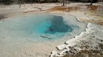
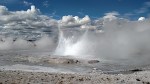
Also unexpected was the fog, which made it hard to see some of the features, especially later in the day as the air was cooling (at Grand Prismatic Spring the fog was very thick and swirling with the wind). The fog also made it challenging to see wildlife and pedestrians along the side of the road. We definitely slowed down leaving the park due to poor visibility; as our elevation decreased, the fog began to dissipate.
We were did walk the Fountain Paint Pots and Grand Prismatic Spring Nature trails. Both were board walks that went past multiple thermal features. These walks were smooth and easy for Alex to navigate, but people added a challenge. There was not a railing at all points to ensure a little boy stayed the course. It required some herding of Alex to make sure he didn’t run into people or fall off the walkway. There were stairs to Grand Prismatic Spring; Fountain Paint Pots did not have stairs, but there was one steeper grade.
Pay attention to park bulletins if you are camping late in the season. We wanted to camp at the Tower Falls campground, but it had closed three days prior. Additionally, there was road construction just south of the North entrance, requiring a significant re-route through the park. After reviewing the campgrounds that were still open (Mammoth Hot Springs, Madison, Slough Creek, and Lewis Lake) , we re-routed to the West entrance because Lewis Lake still had availability and we did not have to take the detour. We drove along the Gallatin River on US-191S; the fall colors were absolutely beautiful along this route.
We exited Yellowstone via the South entrance and drove through John D. Rockefeller Jr. Memorial Parkway and Grand Teton National Park to Coulter Bay Village. This route allowed us an up close view of the damage caused by the fire earlier in the park from earlier this summer. The fire damage, along with the low level of Jackson Lake, emphasized the drought that western states have been suffering.
When is the best time to visit Yellowstone and Grand Teton? We wish we knew. Rangers said that social media (people being warned about the crowded conditions during the summer) has extended the peak season closer and closer to season’s end.
Gallery:
Click on a picture to launch the gallery in a new window
The Gallatin River Valley.
Bison, seen along the roadside from the RV windshield.
We really enjoyed our time in Canada. In Banff National Park, we visited the Upper Hot Springs and hiked the Marsh Loop and continued onto the Sundance Trail. Parks Canada is kind enough to mark there trails as easy (green), intermediate (blue), and advanced (black). However, in some of the intermediate trail descriptions, the elevation gain over the length of the trail calculates to an average 10% grade. If a 10% average grade is considered intermediate, we would hate to see the trail that is marked advanced.
Despite hiking to the Sundance Canyon trail head, we did not hike the canyon due to time constraints. Overall the Marsh Loop was flat and easy walking. Horse tours use this trail, so be prepared to step to the side to allow horses to pass and to dodge road apples as you walk. The Sundance Trail (to the Sundance Canyon trail head) was paved and started out flat. Approximately halfway down the trail, the grade increased and remained consistent for the remainder of the hike to the Canyon. Be cautious of bicyclists coming down from the Canyon.
Hot Springs
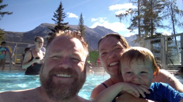
Banff Upper Hot Springs: Our favorite hot springs of the trip. The scenery is fantastic and the locker rooms were very well done. There is not cold pool at this location, so that might have reduced the number of people. Come early in the day, the crowds start to pick up around 11 am. Towel rentals are reasonable, just ask for a locker rental when you are purchasing tickets and you will receive a looney for the lockers. Smallest pool we visited, so it has the potential of feeling crowded during peak hours. There is no parking next to the building, just a drop off area. Parking area was close to the Sulphur Peak gondola route; Alex was excited to watch these strange, new contraptions. The Banff Upper Hot Springs had the coldest water temperature. Children under 3 must wear a water proof swim diaper. Swim suit rentals are also available.
Banff Upper Hot Springs selfie.
Radium Hot Springs: Our second favorite hot spring of the trip. A much larger hot pool, small hot tub, and a cold pool. Heavier usage with less desirable locker room facilities. Unlike Banff Upper Hot Springs, after leaving the locker room, there was a long walk to get to either the hot or cold pool. Admission, towel, and locker fees were the very similar, if not the same, to Banff. Setting was less scenic and there is limited space to place your towel. Added bonus, you are exposed to radon gas. Children under 3 must wear a water proof swim diaper.
Fairmont Hot Springs Resort: Higher admission and towel rental fees. For being a resort, the locker room was looking a bit long in the tooth. Hottest water of the three hot pools. Cold pool with diving board adjacent to hot pool. Alex, despite being unable to swim, wanted to jump off the diving board like the other boys.
Marsh Loop/Sundance Trail Gallery:
Click on a picture to enlarge/begin slide show.
Marsh Loop trail.
Alex enjoying a hike with Penny and Chewie.
Marsh Loop view.
Marsh Loop view.
View from the Sundance Trail. We need to purchase kayaks.
Selfie – Alex is a bit teary because he had to say bye-bye to the horses.
View of a waterfall near the trail head of Sundance Canyon.
Dave working as the pack mule down the Sundance Trail.
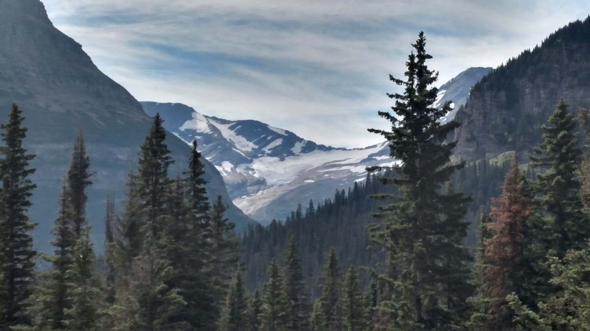
We learned that in Glacier National Park, the ‘crown of the continent’, there is a convergence of plants and animals from diverse environments. The ecosystems of the north (Canada), Maritime (Pacific Northwest), south (Southern Rocky Mountains), and east (prairie species) are found here, the narrowest point of the Rocky Mountain Chain. Water from the park flows to the Pacific Ocean (via the Columbia River), Hudson Bay (Saskatchewan and Nelson Rivers), and the Gulf of Mexico (Missouri and Mississippi Rivers); this convergence of watersheds also promotes the migration and dispersal of plants and animals. This environment is so diverse, all native carnivores – grizzly bears, black bears, wolves, and cougars – are able to survive. The abrupt transition from mountain forest to prairie supports a variety of herbivores – elk, deer, big-horn sheep, and mountain goats – which in turn allow the carnivores to survive.
Creek along Trail of the Cedars.
Going to the Sun Road (driven in a rental car because Abby was too long and tall) provided an excellent example of the diversity that abounds in the park. Starting from the Apgar campground on the west side, we moved through areas that were reminiscent of the Pacific Northwest, which was exemplified by the Trail of the Cedars (handicap accessible board walk/paved trail). Ferns, under towering cedars, dominated the forest floor. As we climbed to Logan Pass, grass became more dominant and wildflowers (Indian Paint brush, bear grass) were in full bloom. We even saw a mountain goat. Over the pass, we pushed on to St. Mary, and the cedars were replaced by dense stands of pine trees.
In the future, when Alex is older, we will take the shuttle. Many of the lots were full (the Logan Pass visitors center was like the mall parking lot at Christmas time), so if we wanted to hike we would not have been able to due to lack of parking.
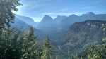
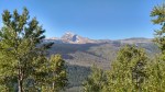
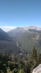
Click on the images below from our trip on Going to the Sun Road to enlarge the picture.
This historic site is located off of I-90 near Deer Lodge, Montana.
History
Johnny Grant, a Canadian, settled in the Deer Lodge Valley of Montana. This area was considered Flathead territory, but it was used as a route to hunting and trading areas by a variety of tribes. Mr. Grant’s marriages to women of several different tribes helped him settle in the valley peacefully.
Conrad Kohrs, a German immigrant, initially came to America in search of gold. He worked as a butcher’s assistant and soon owned butcher shops in many gold camps. (History has shown that very few gold miners got rich, it was the men who ran the supply shops that profited the most.) He partnered with Johnny Grant, who supplied cattle to Mr. Kohrs’ butcher shops. Conrad Kohrs later bought Johnny Grants’ ranch, the latter then returned to Canada.
Due to the large areas of land cattle would roam on the open range, cooperation was required among the ranchers of Montana and resulted in the founding of the Montana Stockgrowers Association. Kohrs’ half brother, John Bielenberg, was Kohrs’ business partner and expert cattleman. John Bielenberg managed the cattle empire and worked to improve the breeding of cow ponies and cattle. The cow ponies Mr. Bielenberg bred were famed for stamina.
After the death of Conrad Kohrs (1920) and John Bielenberg (1922), Conrad Warren, grandson of Conrad Kohrs, took over ranch operations in 1932. He worked to honor his family’s ranching legacy and and run the ranch with new methods. At the time Conrad Warren took over the ranch, only 1,000 acres and few hundred head of cattle remained.
The Grant-Kohrs National Historic site opened in 1977. There are blacksmith demonstrations, a chuck wagon to grab a cup of cowboy coffee (black, no cream, no sugar), and an area to practice your cattle roping skills. There are is a guided house tour and a variety of trails to hike.
What we learned
This is a working ranch. There are chickens, cows, and horses.
We were surprised that the time of the open range was only three decades. The Homestead Act was the beginning of the end to ranches relying on open range.
Pictures
Alex meets Fox, on of the horses on the ranch, at the visitors center.
Our northern California excursion made leaving much harder. We realized that there were so many more adventures we wanted to go on while in California. Unfortunately, the timing did not work out. We will be back someday.
Our route was just shy of 1000 miles, at 982. We averaged approximately 16 mpg for the trip. Abby felt very sporty without the cargo trailer.
Wesport-Union Landing State Beach: Our favorite campground of the trip. Camped on a bluff, overlooking the Pacific Ocean, falling asleep to the sound of the ocean. What more can you ask for? Beach access? Even better. Fantastic campground that the locals know about. You can grab a spot as soon as someone leaves. Make sure there isn’t an item left at the site indicating that a camper is coming back.
Beach that can be accessed from the Westport-Union campground.
Manzanita Lake Campground, Lassen Volcanic National Park: Our second favorite campground. This park has versatility. Hiking, skiing and snowboarding (in June!), and lake activities. A very nice park and informative visitors center. Really enjoyed our hike up to Crags Lake. Other trail-heads accessible in or near the campground; other trails through out the park.
View near Crags Lake.
Stand of young redwoods.
Mill Creek Campground, Redwood National and State Park: Some sites were in some very dense tree cover. We had a sunnier site with a creek directly behind us – Alex loved splashing in the water. Lots of hikes accessible from the campground.
Biggest Pleasant Surprise
Hidden Spring, Humboldt State Forest: Primarily tent camping and some smaller RV and trailers. Abby is only 24 feet and we were glad she wasn’t bigger. We could hike to a beach/swimming hole at the Eel River. Sites are well spaced.
Least Favorite Campground
Mad River Rapids RV Park: Commercial campgrounds are not our first choice. But there was cell service here and that is what we needed for Jess’ phone interview. So here we stayed.