Western Trip: Side Adventures

Our 2015 trip out west was ambitious. We were always on the move and didn’t have many rest days to explore. However, we did manage to include a few fun side trips into our itinerary.

Little Devil’s Tower; Custer State Park, SD:

Sylvan Lake in Custer State Park, South Dakota.

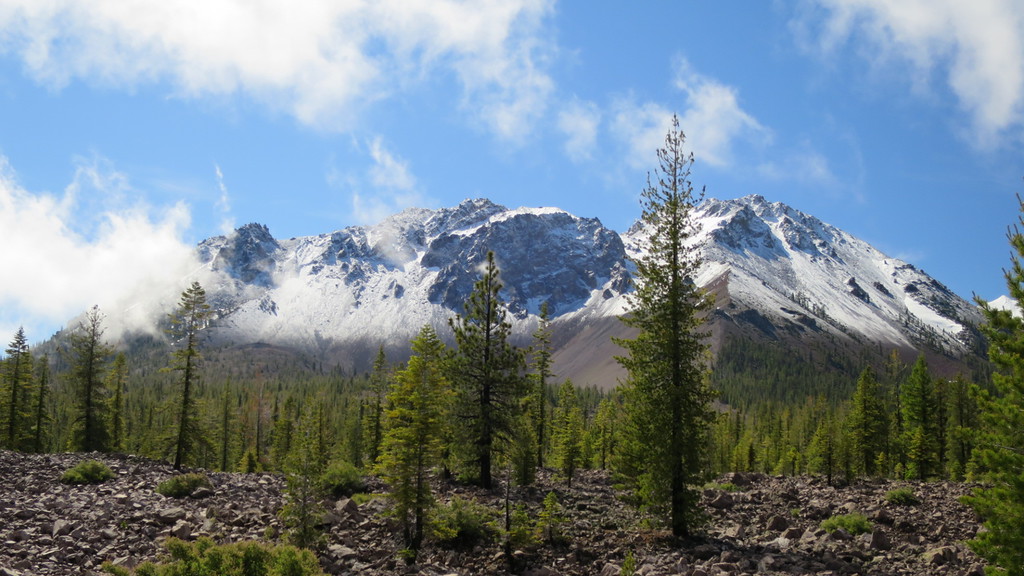
The trail head for this hike in Custer State Park (see trail map) originates at Sylvan Lake. We did not finish this hike because of time constraints – we had to make sure we got back to our campsite before dark. We really enjoyed the hike and wish we had planned our time better. Multiple trails leave the confines of Custer State Park and enter the Black Elk Wilderness. What was really unusual compared to other parks is that pets were allowed on the trails, but had to be leashed. It was a nice experience being able to take Penny and Chewie with us. We also had Ergo as Alex’s carrier; he was getting to heavy to be able to hike long distances comfortably in this carrier.

On the Little Devil's Tower trail.
On the Little Devil’s Tower trail.

Mount Rushmore, SD:

View of Mount Rushmore down the Avenue of Flags.

Conceived by South Dakota historian Doane Robinson, carving likenesses of famous people in the Black Hills region was done to increase tourism. The sculptures were done by Danish-American Gutzon Borglum and his son, Lincoln Borglum. The elder Borglum was instrumental in the selection of Mount Rushmore (the original site, the Needles, had poor quality granite and was opposed by Native Americans) as well as selecting the presidents (George Washington, Thomas Jefferson, Theodore Roosevelt, Abraham Lincoln) to be carved in the mountain.

A close-up of George Washington from the Presidential Trail.

Initially, the presidents were supposed to be depicted from head to waist, but poor quality rock and a lack of funding resulted in the monument we are familiar with today. Construction began in 1927 and ended in 1941, notably with no fatalities.

We walked the trail with Alex, starting down the Presidential Trail towards the Sculptor’s studio. This path wound around and took us under the sculptures. This route had numerous steps, which tired Alex out quite nicely. We completed our loop and returned to the Avenue of Flags; the remainder of the trail after the sculptures was handicap accessible. We ended our visit with vanilla ice cream made following Thomas Jefferson’s recipe.

Durango & Silverton Narrow Gauge Railroad; Durango, CO

View of the gorge that the narrow gauge tracks run along.

Built starting in the fall of 1881, the line was constructed to haul silver and gold ore from the San Juan Mountains in southwest Colorado by the Denver & Rio Grande Railway. The line was completed by July of 1882 and began to haul passengers and freight. The narrow gauge was selected by William Jackson Palmer, a former Union General and experienced railroad man, as it would be well suited to the mountainous country and would have lower construction costs.

RR_02
Alex at Handlebars Restaurant & Saloon.

We took the bus from Durango to Silverton and rode the train back. We kenneled the dogs at Durango Pet Resort. Parking the RV was a bit tricky and we were very lucky to make the bus up to Silverton. Our tour guide was knowledgeable and the bus ride flew by. We ate lunch at Handlebars Restaurant & Saloon; their burgers were pretty good. If our memory serves, they brewed their own beer and it was meh.

Durango & Silverton engine.

The ride back became more of an adventure than we expected. One of the engines broke down bringing a train up to Silverton and the 12:30 train was delayed so the engine could take the 2:30 train back to Durango as well. Needless to say, the double length train did not move very quickly (train ride back took 5 hours). We were not prepared for the extended trip and had not packed enough diapers or food for Alex. Additionally, the train still made all the stops at various trail heads to drop off and pick people up. A really neat option, but it was frustrating after a long day. We didn’t get back to Durango until after the kennel closed, but they had an after hours pick up option and we were able to retrieve Penny, Chewie, and Buster.

Part of our double length train.

It was a beautiful trip.

Garden of the Gods; Colorado Springs, CO

Abby at Garden of the Gods.

Our timing for this visit was poor. We arrived soon after Alex fell asleep. He was not in the mood to go on a long walk through the Garden of the Gods. It was also a hot, sunny day, so we took the dogs with us (allowed); they did not make the circus easier to manage.

We took a short hike and then returned to Abby for lunch and to push on North.

Formation at Garden of the Gods.

Carousel of Happiness; Nederland, CO

The Carousel of Happiness was built by a Marine Vietnam veteran, Scott Harrison. The frame was from the Saltair Park carousel that had its animals removed.  Over the course of 26 years, Mr. Harrison hand carved 50 animals for the carousel, of which, 35 can be ridden.

Alex seemed a bit uncertain about his first ride on the carousel. The carousel is beautiful and is worth the visit.

June 23, 2016 – Westport Union Landing State Beach

Route: US-101S

CARoute05We did not do this drive in one day. It actually took us two. We stopped and stayed at Mad River Rapids RV Park (clean, nice bathrooms, laundry, just a little too developed for our preferences) in McKinleyville, CA the night of June 21st. Cell reception was critical for the morning of the 22nd because Jess had a phone interview for a job. The saving grace of this stop was Six Rivers Brewery, just 5 minutes away from our campground. We enjoyed their beers.

Just south of Eureka, we debated on taking Mattole road along the lost coast. It is a beautiful drive; we have done it before in a rental car and motorcycle. However, it is twisty with lots of up and downs. We decided not to abuse Abby that badly a few weeks before our move to Colorado. We decided to enjoy the drive along Avenue of the Giants for the scenic portion of our drive.

History: Westport and Union Landing were towns supported by the lumber industry. A complex wharf and chute system was used to load the schooners anchored beyond the dangerous rocks with lumber, tanbark, shingles, wool, oats and railroad ties from the bluffs. The town struggled through boom and bust cycles, and the Great Depression diminished Westport further. The town survives today, unlike other lumber towns along the coast.

Campgrounds:

With our late start on the 22nd, we started to look for camping in Humboldt Redwoods State Park. We were shut out the previous night at Prairie Creek Redwoods State Park; this park is very popular and after hiking to Patrick’s Point, it was clear why. Make a reservation, it will be worth it. We were cautiously optimistic about finding a spot in Humboldt Redwoods. The Burlington campground, where we (minus Alex) camped in 2010 was full, and the park staff recommended Hidden Springs. This was a fantastic recommendation. We selected site 9, which was level and had a nice area for Alex and the dogs. There was some road noise, but the number of cars traveling on the road decreased significantly after dusk.

We got off to an early start on Thursday and as we drove by Westport Union Landing State Beach we saw campsites set up. We stopped to investigate and discovered that this is a first come, first serve campground. We snagged a spot for two nights. Initially, there looked to be a limited number of spots, but there are three camping areas.

Activities:

View from Patrick's Point towards Wedding Rock.
View from Patrick’s Point towards Wedding Rock.

Various hiking trails are available at Humboldt Redwoods State Park and Prairie Creek. Prairie Creek will have ocean view trails. At the Eel River swimming hole in Humboldt Redwoods State Park, Alex took great joy in throwing rocks into the river. It is an activity he enjoys.

Alex waiting for a wave to come in so he can throw a rock into the ocean.
Penny and Chewie running on the beach.

2016_Coast05Westport Union Landing State Beach has, well, the beach. This can be walked to and at low tide you can find sand crabs, crabs, giant anemones, and mussels. Alex took a little bit to warm up to the beach and preferred to walk on the harder sand exposed during low tide. Once he discovered this surface, he was eager to run up and down the beach. The dogs were excited to frolic in the surf.

Fort Bragg is about 15 miles down the road. Fort Bragg is the home of North Coast Brewing Company and their very tasty beers. There is a tourist train, called the Skunk Train, that takes riders on a forty mile tour through redwoods and mountain meadows. We missed an opportunity to take Alex on a train ride that he would have loved. There is also Glass Beach, where beauty has resulted from a former city dump.

Overall: Fantastic camping spot. Need to be quick to grab a site. The proximity to Fort Bragg provides extra activities. We could have spend our entire trip camped out on the bluffs.

Morning view from our campsite.

June 20, 2016 – Crescent City, Mill Creek

CARoute04Route: CA-96W, Indian Creek Road, US-199S

We got off to a relatively early start because the day’s activities included grocery shopping and laundry! We were westward bound on CA-96W until Happy Camp. We stopped at the Frontier Saloon and Cafe for second breakfast; Dave finally staged his uprising against granola and yogurt and insisted we stop. Portions were generous, food was good. Bacon was amazing – thick cut, not overly salted. Stop in if you are in town.

Our route took us through a remote area; the steep mountain slopes are not conducive to building. The road was twisty and when we crossed into Oregon, Abby earned another state badge. We debated on detouring to the Oregon Caves National Monument and Preserve, but it was 45 minutes out of our way and we needed clean undies. We turned south to Crescent City. We arrived and wanted to stop and Port O’Pints, but they didn’t open until 2. And there was no food as far as we could tell. Pre-made salad from Safeway for the lunch win!

Dave standing by the stump of a redwood.

History: Redwood logging began in 1851, as the gold rush waned. Technological advances made it easier and faster to harvest the large trees. In 1920, key groves were preserved by the State of California. In 1968, Congress created Redwood National Park, protecting the world’s tallest trees and Redwood Creek’s salmon fishery.

Redwood log next to campsite 40.

Coast redwoods have been recorded at 370 feet, almost 70 feet taller than the giant sequoia. There are no known killing diseases and are resistant to insects, believed to be the result of high tannin concentrations, which also provides the red hue to the wood. Fog, created by the hot air of the central valley pulling moisture laden ocean air towards the interior of CA, is key to the survival of the coastal redwood.

Stand of young redwoods.

Redwood National and State Parks are a cooperative management effort between the National Park Service and the California Department of Parks and Recreation. Redwood National Park, Jedediah Smith Redwoods State Park, Del Norte Coast Redwoods State Park, and Prairie Creek Redwoods State Park are part of the cooperative effort and form a World Heritage Site and International Biosphere Reserve.

Campground: We stayed at Mill Creek campground in Del Norte Coast Redwoods State Park. We were lucky to get a walk-up site, number 41. Sites 40 through 42 are spaced the closest and receive the most sunlight. The sites are level and have easy access to Mill Creek. Sites 39 and 55 are prime sites, spacious and well separated from neighboring campsites. Overall, most sites in the camp well spaced. There are some tent only sites that are extremely secluded – you hike to the tent platform through a tunnel in the foliage.

Alex enjoying the rocks in Mill Creek.

Activities: Fishing in the park tributaries of the Smith River for cutthroat trout and hatchery steelhead is permitted. Mill Creek is closed to fishing part of the year. A license is required.

Alex enjoying the hike along Trestle Trail on his pack mule.

There are a variety of trails for hiking in the park. The Trestle Trail Loop circumvents sites 1 – 74. Off of this trail, one can access the Adler Basin, Saddler Skyline, and Hobbs Wall (via Saddler Skyline) trails. The California Coastal Trail, which is 1200 miles long, runs through the park. Also in the park is the Damnation Trail, which was used by the Tolowa Indians to reach the ocean to gather shellfish and seaweed. This trail drops 1,000 feet over two miles through old-growth redwoods and Sitka spruce. We thought about attempting this hike, but wisely did the math in advance. The average grade on the trail is 10%. We opted for the Trestle Loop Trail instead. This trail was a combination of a relatively flat and wide path (good for Alex to walk a bit) and some narrow, steep hillside hiking (good time to contain Alex in the pack).

Overall: This was a fantastic campground and would be a fantastic place to set up home base for a couple of weeks and explore the coast. There are endless day trip possibilities. Also, the proximity to Crescent City means it is easy to restock food and clean clothes.

Banana slug
Banana slug

June 17, 2016 – Lassen Volcanic National Park

CARoute02
The route traveled to Lassen Volcanic National Park.

Route: CA-89N

As we drove, Dave commented that the landscape was feeling less like California (grey, rocky mountains) and more like the Pacific Northwest (thick pine forests, lots of logging trucks). A quick consult with the map showed that Lassen National Forest straddles the Sierra and Cascade ranges, which are quintessential California and Pacific Northwest, respectively. The drive was picturesque, with twisty roads following creeks and cutting along the mountain. All the plants were freshly green, having recently shaken off winter’s chill.

Abby parked at the Lassen Peak trail head.

We were expecting to see much more snow during the drive, since CA-89, the Lassen Volcanic National Park through road, had only recently been cleared of snow and opened. However, we only saw occasional patches of snow. Then we started to climb as we entered the park and the odds were in our favor (and Penny’s) significant snow. It did not take long after entering the park before there was snow, and significant quantities.  The drive was a bit harrowing with the thick fog, but the positive side was we could not see the steep drop offs along the road. If you feel that the government is over protecting you, drive the road through Lassen. There isn’t much government protection standing between you and the drop off.

2016_Lassen04
300 ton rock landed 3 miles from Mount Lassen after the 1915 eruption.

History: Designated a National park on August 9, 1916, in part due to the continuing volcanic activity after the 1915 eruption. President Theodore Roosevelt initially protected the area with the formation of Cinder Cone National Monument and Lassen Peak National Monument in 1905.

Native Americans inhabited the area and believed that Lassen would one day blow itself apart. Lassen Peak was used as a landmark for immigrants on their way to the fertile Sacramento Valley.

Campground: We stayed at the Manzanita Lake campground, in the Northwest corner of the park; this was the only campground open. The other campgrounds were still being cleared of winter related damage. This campground has four loops. Sites can be reserved on loops A and C, loops B and D are first come, first served. Loop D is for tent camping only. There are multiple trail heads in or close to the campground (Manzanita Creek, Crags Lake, Manzanita Lake, Lily Pond Nature Trail, Reflection Lake, Nobles Emigrant). We were in site C44, which was spacious with and felt secluded. Other prime sites in the C loop include C22, C24, C25, and C26. There is no cell service.

2016_Lassen06
Alex sleeping during the hike to Crags Lake.
Heading over the crest to Crags Lake.
View of Chaos Crags from Crags Lake.

Activities: Kayaks can be rented from the camp store for use on Manzanita Lake. We decided to hike the Chaos Crags trail. The sign at the trail head, which was a solid 0.5 miles away from our campsite, indicated a 2 mile walk with approximately 825 feet of elevation increase. Simple math, done at leisure after the hike, determined that the average grade of the trail was 8%. Math, it rocks. There were sections that were rather flat, and sections that were very steep. The 4 mile round trip took us about 3.5 hours. This time includes the 30 minutes we spent at Crags Lake watching Alex throw rocks into the water and laugh at the ‘bloops’. The hike offered amazing views and took us throw an area that had been affected by fire. The hike was sunnier than expected due to reduced tree cover. And there is cell service! We definitely were sore after this hike.

2016_Lassen09
Snow field along a creek. Penny is clearly happy.

Skiing and snowboarding are also options for activities! In June! Our first night camping, it rained at the campground, but higher elevations received approximately six inches of snow. The through road was closed again to allow for plowing.

Ski and snowboarders at the Lassen trail head.

The Kohm Yah-mah-nee Visitor Center has great interactive displays. There is a description of the different types of volcanoes (cinder cone, composite, plug flow) and an interactive map that will light up the type examples with in the park with the push of a button (Alex loved this). Another interactive exhibit had a tunnel that was perfect for a toddler to run through; a light lit up as Alex ran through the tunnel. This was also a great source of joy. Two gift shops, an area with children’s toys, a cafe, and theater round out the offerings at the visitor center.

Overall: This is a beautiful park with hiking options that we did not even scratch the surface of in regards to activities and hikes. Note that if you are interested in the Lave Tube caves, which are located in Lassen National Forest, about 45 minutes north on CA-44/CA-89. As our usual, we wish we were spending more time here.

Mount Lassen with a fresh coat of snow.

June 15, 2016 – Plumas Eureka State Park

Route to Plumas Eureka State Park.

Route: I-80E, CA-49N, CA-89N, A414

Google estimated travel time was approximately 3 hours if we used I-80E for the majority of the trip. On the advice from a friend, we overruled Google Maps and took CA-49N, which would add an estimated 30 minutes to the trip. In Abby, the extra time was closer to an hour. Include the road construction, it was an additional 90 minutes.

CA-49N is a twisty, scenic drive through Tahoe and Plumas National Forests. The road follows various branches of the Yuba River at different points. The river looks to be a kayaker’s and fisherman’s paradise with boulders, fast flowing sections, and large pools. There are multiple opportunities to camp in Sierra County at National Forest campgrounds adjacent to CA-49N. We also saw a number of signs indicating boat launches down lake access roads.

Yes, the route we took came close to forming a circle at the end.

Abby in campsite 36 at Plumas Eureka State Park.

History: The Plumas Eureka State Park region was originally inhabited by the Northern Maidu, who lived along valley edges and hunted in the mountains during the warm seasons. They were known for their coiled and twined baskets and intricate bead-work.

In 1851, the isolation of the Maidu ended when gold was discovered on an exposed quartz ledge of Eureka Peak. The influx of European settlers brought disease, destroyed native food and plant resources, and inflicted violence that was catastrophic to the Maidu population.

Jamison City and Johnsville were established for the miners. Smaller mining companies closed as surface deposits diminished. A British company purchased and consolidated the mines in 1872. The mines operated profitable until 1890 and were sold in 1904. Operations tapered off until they were ended during World War II by the War Production Board Limitation Order. The mines’ 65 miles of tunnels generated more than $8 million in gold, which was processed by the Mohawk Stamp Mill.

To entertain themselves, miners held snowshoe and ski races. In the ski races, competitors could reach speeds of more than 80 miles per hour. It is believed that the mine tramways may have served as the world’s first ski lifts.

Campground: We weren’t sure what to expect with the Plumas Eureka campground. Experience with CA state parks is approximately 66% positive (Morro Bay, New Brighton State Beach, Half Moon Bay) and we were hoping that after this stay, 3 out of 4 parks would have exceeded expectations. We weren’t disappointed.

The park rangers are VERY serious about protecting bears from habituation to humans. You must read a statement upon check in regarding proper storage of food and trash at your site and the dangers to you and the bear if you do not follow the regulations; there is a $1000 fine if you are found to be in violation of the rules. Your signature on the registration receipt is required to acknowledge the information.

The campground is approximately a mile down the road from the mining museum, located at the base of Mount Eureka, that has the registration window. There is a mix of walk-in only and RV/trailer sites. all sites have a picnic table, fire pit, metal food storage box, and a large level area for tent set up. Despite the scale on the map, all sites are spacious and wooded with various types of trees (white fir, Douglas fir, ponderosa, sugar, Jeffrey, lodge-pole, incense cedar). There are even some giant sequoias and a creek running through the campground. Our spot number was 36, which was a little uneven, but was fixed with blocks under the front tires. Sites 9 – 14, and 19 – 20 are secluded and within easy walking distance to the showers.

The shower facilities were clean, and as of June 2016, free. We did not try them out. California was experiencing unseasonable cold weather and we saw snow flurries our first night. We’re not walking around wet, in the cold, while Abby had a functional shower. The toilet facilities have flush toilets, but no hot water.

Activities: There is a trail from the campground to the museum. The museum is located in the historic miners’ bunkhouse and has natural history exhibits, archaeological finds, mining artifacts, a working scale model of the stamp mill, and hands on exhibits for kids. You can even pan for gold. Some buildings are open in the mining complex, but check with the museum to confirm days and times.

The campground also provides access to the Talking Forest Nature Trail and Grass and Smith Lakes Trail. These trails to exit the state park and enter national forest land. Within the park, there are also trail heads to Eureka Peak Madora Lake, and others into national forest land.

Fishing along Jamison Creek in the park is not always rewarding, but there are other streams and lakes in the area that offer better odds.

Check out The Brewing Lair. It is about a 10 minute drive from the campground at Plumas Eureka State Park. We loved their phenomenal setting and enjoyed their beer. Well done.

Overall: We enjoyed this park. We didn’t hike as much as we would have liked; we are always trying to hit a moving target as Alex abilities and nap schedule change as he grows. A positive experience.