
More detail about the campgrounds our Pacific Northwest trip. We stayed at a couple municipal campgrounds (Campground by the Lake, Saratoga Lake Campground), a commercial campground, NFS and BLM campgrounds, national park campgrounds and dispersed camped.
Picture galleries are interspersed through out this post. Click on a picture to view in a new window.
Favorites:
- Kalaloch Campground: Camping on the a bluff over the Pacific Ocean? Only way it would have been better was some sunnier weather. We had to play the walk-up game and camped the first night in B-17 (spur within the A loop). This site was spacious and relatively level. It was farther away from the bluff in the trees. On the second night we scored the bluff site A-25, a large rather private site with trees and bushes separating us from neighbors on both sides. A-27 is a very similar site. Some minor leveling was required in A-25. D loop prime sites are D-24 to D-30; D-24 is on the bluff while the other sites are across the road from bluff. All have clear views of the ocean.
Looking down the beach towards the Kalaloch lodge. 
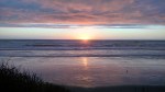
Sunset at Kalaloch 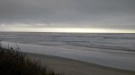
A stormy Pacific at Kalaloch. 
Morning at Kalaloch after a stormy night. - Lone Fir Campground: Just off of WA-20 in the Okanogan-Wenatchee National Forest, this campground is tucked in amongst the trees with a creek running along the back campsites. These sites (~14 to ~20) are the prime sites and were occupied when we came through. We camped in site 23, which was level and a pull through. This was one of the larger sites at the campground. Sites 23 – 26 are large and would be top on our list for camping in despite the proximity to the (little traveled) road.
- Water Canyon Recreation Area: This is a campground on BLM land near Winnamucca, NV. This canyon has a creek running through it. Along that creek are apsens; creating a stark contrast with the surrounding desert. After crossing onto BLM land, there is a campsite up the road approximately 1 mile. This site has along the creek and is lower than the road. It is a little hard to see because there is a site adjacent to the road, don’t be fooled, this a separate site in a prime location. Continuing another mile up the road, there is another site right along the creek in a large clearing. We didn’t level up on this site as well as we would have liked, but it nice. Alex was able to play in the creek and we hiked up the upper access road (closed in the winter). There are additional campsites accessible if you have a high clearance vehicle.
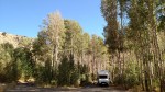
Abby at Water Canyon 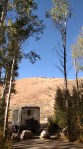
A rather arid landscape across from our campsite. 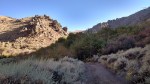
Hiking the upper road in Water Canyon. 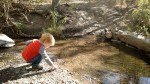
Alex playing in the creek at Water Canyon. 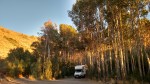
Sunset at Water Canyon.
Least Favorites:
None really. If anything we found South Beach State Park to be a little crowded, but it was close to town and had beach access. We weren’t on the beach, but close enough.
Also note that the bike path in South Lake Tahoe is a joke. It is narrow and unpaved at places. Where it is unpaved the transition is from bumpy black top to sand. If riding at night, a bright light is a must.
Biggest Pleasant Surprise:
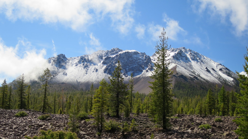
Lava Beds National Monument: We did not know what to expect heading to this campground. The campground is at the south end of the park, and fortunately for us, we came in the south entrance. We arrived to find a nice mix RV and walk-in tent spots. We stayed in B23, one of the larger sites that could accommodate a RV in the mid-30 foot range. Most sites were relatively flat. Be sure to check the site stubs closely, we found that were several days expired; it doesn’t seem that the rangers come through that often to remove the expired stubs.
The campground was within a quarter mile of two caves (Indian Wells and Mushpot) and the visitors’ center. The visitors’ center had a great brochure outlining the difficulty of the caves. There were several trail heads within the campground or at the visitors’ center that provided access to a variety of caves.


Commercial Campground:
Camp Coeur d’Alene got our business because we needed to dump and our RV dump station app had already failed us twice. Combined with Alex waking up early from a nap, our goal to push further east was thwarted. Technically camped along the shores of Lake Coeur d’Alene and took Alex out on a paddle boat. There was plenty of space for Alex to run around. We dumped our black and grey tanks, filled up with fresh water, and did laundry to ensure clean underwear all the way home.
Dispersed Camping:
After a successful dispersed camping experience in Bighorn National Forest during our Northern Rockies trip, Dave was looking forward to another positive experience. This experience did not start out as well as it was difficult to determine where the Beaverhead-Deerlodge National Forest began and private property ended. It also didn’t help that we were on the fringes of the national forest and the road passed in and out of the forest.
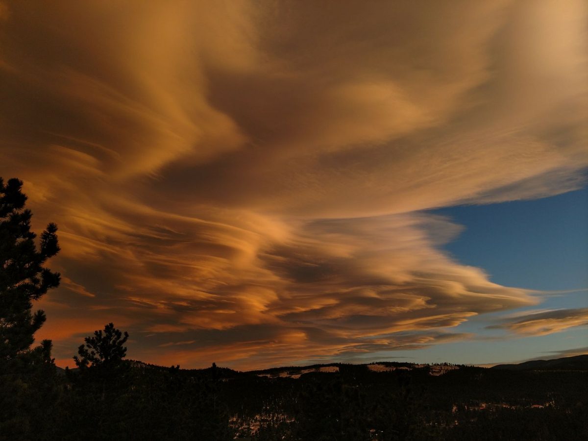
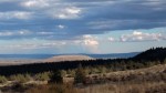
We found a decent spot to pull off the road and set up camp. Slightly pitched to the left and front, we decided to walk further up the road. The view did not disappoint.
The night was a little creepy – Jess heard a four wheeler come down the hill and was positive it stopped near the RV. She then thought she heard someone(s) walking around the RV. The dogs did not bark, but she woke up Dave anyway. It was not a restful night, although everyone came out of the experience unharmed. If we had continued on MT-43E for about 10 more miles, we would have come upon a campground just shy of I-15. This campground was along the Big Hole River in a stand of trees. If you are in the area, check this campground out before going off into the wilderness.


 We did not do this drive in one day. It actually took us two. We stopped and stayed at


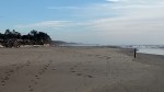
 Westport Union Landing State Beach has, well, the beach. This can be walked to and at low tide you can find sand crabs, crabs, giant anemones, and mussels. Alex took a little bit to warm up to the beach and preferred to walk on the harder sand exposed during low tide. Once he discovered this surface, he was eager to run up and down the beach. The dogs were excited to frolic in the surf.

 Route: CA-96W, Indian Creek Road, US-199S