Pacific Northwest: Trip Summary

This trip was our last major trip for the season. While not solely a tour of the Pacific Northwest, we started in South Lake Tahoe where we met up with friends of the motorcycling persuasion. After consulting with the National Parks Passport book, we planned our route to pick up cancellations at Lava Beds National Monument and Crater Lake National Park.

The severity of the Western drought and the importance of fully researching park alerts before route planning were highlighted during this trip. Our first night was spent at Rockport State Park, along the Rockport Reservoir (Utah). This reservoir was easily 40 to 50 feet lower than its historic level; this translate to filled at 35% capacity and is dropping. Proper research was emphasized when we went to North Cascades National Park and discovered the campground closures due to fire and weekend only visitor center hours after we arrived. Whoops. Might have gone to visit Mount Rainier instead, but then we would have missed out on seeing Port Townsend, WA (absolutely charming town).

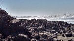
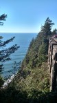
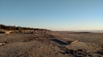
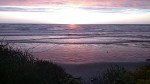
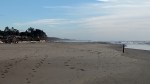
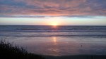
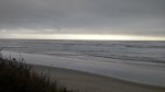
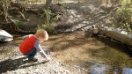
We really enjoyed visiting the coast. Alex, Dave, and the dogs loved the beaches. Jess enjoyed the beach, but mumbled grouchy things towards all the sand that was tracked into Abby. The major downside to the coast was the pervasive dampness (that and the lingering smell of fish in Abby). Nothing dried quickly. It was rather nice to return to a more arid climate.

This was an aggressive trip. On average, we drove 245 miles/day. Which is a minimum of 5 hours in Abby. We got to see a large number of attractions, but only in a superficial manner. For our next trip, our goal is to pick a major area of interest and some minor areas of interest for the route to and from. Drive in a rather direct fashion to our area of major interest and camp there for a week. This will allow us to do more exploring and hiking. Fortunately, we have all winter to choose a destination.

pacificnwroute
Our Pacific Northwest route.

Mileage and Fuel Consumption:

Total days: 17

Total miles: 4172.6

Total gallons diesel: 244.6

Average miles per gallon: 17.1

Best miles per gallon: 19.4

Worst miles per gallon: 13.8

Abby gave us a beautiful tank of 19.4 mpg as we came east across Wyoming. We may have had an aiding tail-wind, but we will take it.

Campgrounds:

For our campground summary post, follow this link.

  1. Rockport State Park, UT (1)
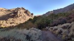
  2. Water Canyon Recreation Area (BLM), south of Winnemucca, NV (1)
  3. Campground by the Lake, South Lake Tahoe, CA (2)
  4. Lava Beds National Monument, CA (1)
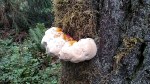
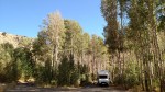
  5. Steamboat Falls Campground, Umpqua National Forest, OR (1)

    img_20160919_184020863
    A heavily wooded campsite at Steamboat Falls. Watch out for poison oak in the sunnier sites!
  6. South Beach State Park, Newport, OR (1)
  7. Cape Disappointment State Park, Ilwaco, WA (1)

    Lighthouse at Cape Disappointment in Washington.
    Lighthouse at Cape Disappointment in Washington.
  8. Kalaloch Campground, Olympic National Park, WA (2)
  9. Fairholme Campground, Olympic National Park, WA (1)
  10. Heart O’ the Hills Campground, Olympic National Park, WA (1)
  11. Lone Fir Campground, Okanogan-Wenatchee National Forest, WA (1)
  12. Camp Coeur d’Alene, Coeur d’Alene, ID (1)
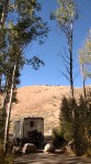
  13. Dispersed camping Harriet Lou Road, Beaverhead-Deerlodge National Forest, MT (1)
  14. Lewis Lake Campground, Yellowstone National Park, WY (1)
  15. Saratoga Lake Campground, Saratoga, WY (1)

Breweries

This is a rather short brewery list, considering we drove through the Pacific Northwest. Alas, timing thwarted our best intentions to visit breweries. It would be a lot easier if breweries would open up in National Forest campgrounds.

  1. The Brewery at Lake Tahoe
  2. Jack Russell Farm Brewery
  3. Rogue Ales & Spirits
  4. Next Door Gastropub – okay this isn’t really a brewery. Excellent food and regional beer selection, so it is getting listed anyway.

For more detail regarding our brewery visits, check out this post.

National Monuments/Historic Sites:

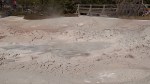
  1. Lava Beds National Monument – our experiences posted here.
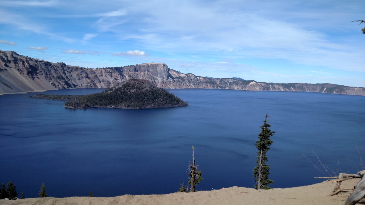
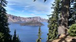
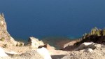
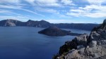
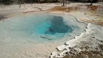
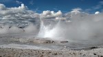
  2. Crater Lake – for more information, click here.
  3. Lewis and Clark National Historic Park
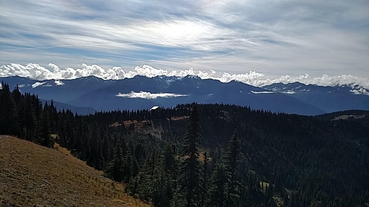
  4. Olympic National Park – post of our experience is here.
  5. Ebey’s Landing National Historical Reserve
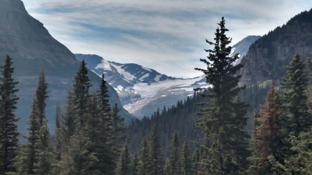
  6. North Cascades Park
  7. Big Hole National Battlefield – for more information, click here.
  8. Yellowstone National Park – for more information, click here.
  9. John D Rockefeller, Jr. Memorial Parkway
  10. Grand Teton National Park

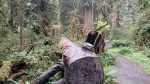
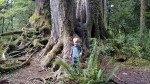
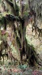
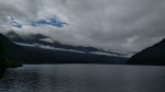
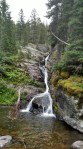
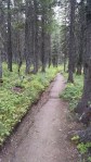
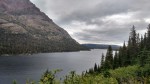
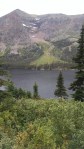
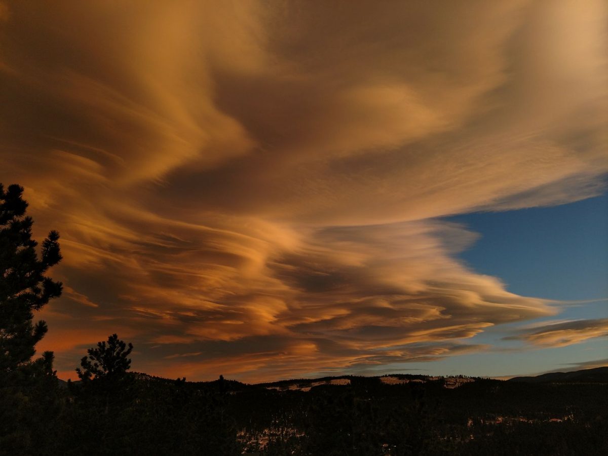
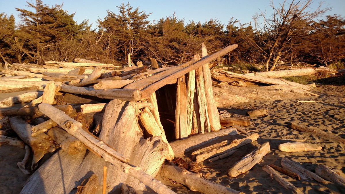
Gallery: Oregon and Washington Coast


Pacific Northwest: Olympic National Park

What a park. From coastal bluffs to glacier peaks, this park is rich with diversity in all dimensions. Olympic National Park ecology is comprised of mountains, lakes, lowland forests, rivers, coast, and temperate rain forest. Mountain flora and fauna include glacier lilies, lupine, bistorts, tiger lilies, subalpine firs, and black tailed deer. At the coast, the tide pools are rich with sea anemones, sea urchins, sea stars, and limpits. The temperate rain forest receives more than 12 feet of rain a year, creating an environment for giant western hemlock, Douglas-fir, Sitka spruces, bigleaf maples, and a variety of mosses to thrive. Roosevelt elk and beers can also be found in the rain forest.

We started at the coast, camping at Kalaloch. We saw sand dollars and ctenophores on the beach. The salmon were running at the Salmon Cascades in the Sol Duc River to spawn (late September); they can also be seen in the Hoh River, but not until November/December. We hiked the Spruce Nature (1.2 miles – Alex walked the whole thing!) and the Hall of Mosses (0.8 miles) trails in the Hoh Rain Forest. The Spruce Nature trail had very little elevation change and was relative smooth. The Hall of Mosses had more of an elevation change, but after the initial climb, was relatively flat. There is even a trail to Blue Glacier (15 miles one-way); check out the elevation profile of this trail at the visitors center. We did not attempt the Blue Glacier trail. We saw Hurricane Ridge on a clear day, and it was gorgeous. Hurricane Ridge also serves a a squeegee for the moisture in the air. The west (windward) side has forests and is lush, while the east (leeward) side is arid and has few trees.

We could have easily spent two weeks here, hiking and exploring the area. The park has astronomy programs at Hurricane Ridge.

Gallery:

Pacific Northwest: Crater Lake

Crater Lake was formed when Mount Mazama, a 12,000-foot volcano, violently erupted approximately 7,700 year ago. No longer able to support its own weight once the magma chamber was emptied, Mount Mazama collapsed and a caldera was formed. This caldera then filled with rain and snowfall. Since no streams run into the lake, there is very little sediment to cloud the water.

The lake has thick mats of bacteria at depths where there is no light. There are also thick rings of moss, reaching depths of 400 feet, along the caldera walls. Hydrothermal pools have also been discovered, indicating a volcanic heat source. Mount Mazama may be dormant, but it is not extinct.

Our visit to Crater Lake was a drive through due to time constraints. There were also some closures in the park due to trail repair. The only campground for RVs is Mazama Village. The park is beautiful an is on our list to return to.

Gallery: Click on a picture to open the gallery.

Pacific Northwest: Camping

More detail about the campgrounds our Pacific Northwest trip. We stayed at a couple municipal campgrounds (Campground by the Lake, Saratoga Lake Campground), a commercial campground, NFS and BLM campgrounds, national park campgrounds and dispersed camped.

Picture galleries are interspersed through out this post. Click on a picture to view in a new window.

Favorites:

  1. Kalaloch Campground: Camping on the a bluff over the Pacific Ocean? Only way it would have been better was some sunnier weather. We had to play the walk-up game and camped the first night in B-17 (spur within the A loop). This site was spacious and relatively level. It was farther away from the bluff in the trees. On the second night we scored the bluff site A-25, a large rather private site with trees and bushes separating us from neighbors on both sides. A-27 is a very similar site. Some minor leveling was required in A-25. D loop prime sites are D-24 to D-30; D-24 is on the bluff while the other sites are across the road from bluff. All have clear views of the ocean.
  2. Lone Fir Campground: Just off of WA-20 in the Okanogan-Wenatchee National Forest, this campground is tucked in amongst the trees with a creek running along the back campsites. These sites (~14 to ~20) are the prime sites and were occupied when we came through. We camped in site 23, which was level and a pull through. This was one of the larger sites at the campground. Sites 23 – 26 are large and would be top on our list for camping in despite the proximity to the (little traveled) road.
  3. Water Canyon Recreation Area: This is a campground on BLM land near Winnamucca, NV. This canyon has a creek running through it. Along that creek are apsens; creating a stark contrast with the surrounding desert. After crossing onto BLM land, there is a campsite up the road approximately 1 mile. This site has  along the creek and is lower than the road. It is a little hard to see because there is a site adjacent to the road, don’t be fooled, this a separate site in a prime location. Continuing another mile up the road, there is another site right along the creek in a large clearing. We didn’t level up on this site as well as we would have liked, but it nice. Alex was able to play in the creek and we hiked up the upper access road (closed in the winter). There are additional campsites accessible if you have a high clearance vehicle.

Least Favorites:

None really. If anything we found South Beach State Park to be a little crowded, but it was close to town and had beach access. We weren’t on the beach, but close enough.

Also note that the bike path in South Lake Tahoe is a joke. It is narrow and unpaved at places. Where it is unpaved the transition is from bumpy black top to sand. If riding at night, a bright light is a must.

Biggest Pleasant Surprise:

Lava Beds National Monument: We did not know what to expect heading to this campground. The campground is at the south end of the park, and fortunately for us, we came in the south entrance. We arrived to find a nice mix RV and walk-in tent spots. We stayed in B23, one of the larger sites that could accommodate a RV in the mid-30 foot range. Most sites were relatively flat. Be sure to check the site stubs closely, we found that were several days expired; it doesn’t seem that the rangers come through that often to remove the expired stubs.

The campground was within a quarter mile of two caves (Indian Wells and Mushpot) and the visitors’ center. The visitors’ center had a great brochure outlining the difficulty of the caves. There were several trail heads within the campground or at the visitors’ center that provided access to a variety of caves.

Commercial Campground:

Camp Coeur d’Alene got our business because we needed to dump and our RV dump station app had already failed us twice. Combined with Alex waking up early from a nap, our goal to push further east was thwarted. Technically camped along the shores of Lake Coeur d’Alene and took Alex out on a paddle boat. There was plenty of space for Alex to run around. We dumped our black and grey tanks, filled up with fresh water, and did laundry to ensure clean underwear all the way home.

Dispersed Camping:

After a successful dispersed camping experience in Bighorn National Forest during our Northern Rockies trip, Dave was looking forward to another positive experience. This experience did not start out as well as it was difficult to determine where the Beaverhead-Deerlodge National Forest began and private property ended. It also didn’t help that we were on the fringes of the national forest and the road passed in and out of the forest.

We found a decent spot to pull off the road and set up camp. Slightly pitched to the left and front, we decided to walk further up the road. The view did not disappoint.

The night was a little creepy – Jess heard a four wheeler come down the hill and was positive it stopped near the RV. She then thought she heard someone(s) walking around the RV. The dogs did not bark, but she woke up Dave anyway. It was not a restful night, although everyone came out of the experience unharmed. If we had continued on MT-43E for about 10 more miles, we would have come upon a campground just shy of I-15. This campground was along the Big Hole River in a stand of trees. If you are in the area, check this campground out before going off into the wilderness.


Pacific Northwest: Yellowstone and Grand Teton

We last visited Yellowstone in July of 2015, and were frustrated by the shear number of people also there. We thought that coming later in the season would improve our experience, as less people would be there. While the crowds were reduced at the end of September compared to July, there were many more people than we expected.

Also unexpected was the fog, which made it hard to see some of the features, especially later in the day as the air was cooling (at Grand Prismatic Spring the fog was very thick and swirling with the wind). The fog also made it challenging to see wildlife and pedestrians along the side of the road. We definitely slowed down leaving the park due to poor visibility; as our elevation decreased, the fog began to dissipate.

We were did walk the Fountain Paint Pots and Grand Prismatic Spring Nature trails. Both were board walks that went past multiple thermal features. These walks were smooth and easy for Alex to navigate, but people added a challenge. There was not a railing at all points to ensure a little boy stayed the course. It required some herding of Alex to make sure he didn’t run into people or fall off the walkway. There were stairs to Grand Prismatic Spring; Fountain Paint Pots did not have stairs, but there was one steeper grade.

Pay attention to park bulletins if you are camping late in the season. We wanted to camp at the Tower Falls campground, but it had closed three days prior. Additionally, there was road construction just south of the North entrance, requiring a significant re-route through the park. After reviewing the campgrounds that were still open (Mammoth Hot Springs, Madison, Slough Creek, and Lewis Lake) , we re-routed to the West entrance because Lewis Lake still had availability and we did not have to take the detour. We drove along the Gallatin River on US-191S; the fall colors were absolutely beautiful along this route.

We exited Yellowstone via the South entrance and drove through John D. Rockefeller Jr. Memorial Parkway and Grand Teton National Park to Coulter Bay Village. This route allowed us an up close view of the damage caused by the fire earlier in the park from earlier this summer. The fire damage, along with the low level of Jackson Lake, emphasized the drought that western states have been suffering.

When is the best time to visit Yellowstone and Grand Teton? We wish we knew. Rangers said that social media (people being warned about the crowded conditions during the summer) has extended the peak season closer and closer to season’s end.

Gallery:

Click on a picture to launch the gallery in a new window


Northern Rockies: Oh Canada!

We really enjoyed our time in Canada. In Banff National Park, we visited the Upper Hot Springs and hiked the Marsh Loop and continued onto the Sundance Trail. Parks Canada is kind enough to mark there trails as easy (green), intermediate (blue), and advanced (black). However, in some of the intermediate trail descriptions, the elevation gain over the length of the trail calculates to an average 10% grade. If a 10% average grade is considered intermediate, we would hate to see the trail that is marked advanced.

Despite hiking to the Sundance Canyon trail head, we did not hike the canyon due to time constraints. Overall the Marsh Loop was flat and easy walking. Horse tours use this trail, so be prepared to step to the side to allow horses to pass and to dodge road apples as you walk. The Sundance Trail (to the Sundance Canyon trail head) was paved and started out flat. Approximately halfway down the trail, the grade increased and remained consistent for the remainder of the hike to the Canyon. Be cautious of bicyclists coming down from the Canyon.

Hot Springs

  1. Banff Upper Hot Springs: Our favorite hot springs of the trip. The scenery is fantastic and the locker rooms were very well done. There is not cold pool at this location, so that might have reduced the number of people. Come early in the day, the crowds start to pick up around 11 am. Towel rentals are reasonable, just ask for a locker rental when you are purchasing tickets and you will receive a looney for the lockers. Smallest pool we visited, so it has the potential of feeling crowded during peak hours. There is no parking next to the building, just a drop off area. Parking area was close to the Sulphur Peak gondola route; Alex was excited to watch these strange, new contraptions. The Banff Upper Hot Springs had the coldest water temperature. Children under 3 must wear a water proof swim diaper. Swim suit rentals are also available.

    Banff Upper Hot Springs selfie.
    Banff Upper Hot Springs selfie.
  2. Radium Hot Springs: Our second favorite hot spring of the trip. A much larger hot pool, small hot tub, and a cold pool. Heavier usage with less desirable locker room facilities. Unlike Banff Upper Hot Springs, after leaving the locker room, there was a long walk to get to either the hot or cold pool. Admission, towel, and locker fees were the very similar, if not the same, to Banff. Setting was less scenic and there is limited space to place your towel. Added bonus, you are exposed to radon gas. Children under 3 must wear a water proof swim diaper.
  3. Fairmont Hot Springs Resort: Higher admission and towel rental fees. For being a resort, the locker room was looking a bit long in the tooth. Hottest water of the three hot pools. Cold pool with diving board adjacent to hot pool. Alex, despite being unable to swim, wanted to jump off the diving board like the other boys.

Marsh Loop/Sundance Trail Gallery:

Click on a picture to enlarge/begin slide show.

Northern Rockies: Going to the Sun Road

We learned that in Glacier National Park, the ‘crown of the continent’, there is a convergence of plants and animals from diverse environments. The ecosystems of the north (Canada), Maritime (Pacific Northwest), south (Southern Rocky Mountains), and east (prairie species) are found here, the narrowest point of the Rocky Mountain Chain. Water from the park flows to the Pacific Ocean (via the Columbia River), Hudson Bay (Saskatchewan and Nelson Rivers), and the Gulf of Mexico (Missouri and Mississippi Rivers); this convergence of watersheds also promotes the migration and dispersal of plants and animals. This environment is so diverse, all native carnivores – grizzly bears, black bears, wolves, and cougars – are able to survive. The abrupt transition from mountain forest to prairie supports a variety of herbivores – elk, deer, big-horn sheep, and mountain goats – which in turn allow the carnivores to survive.

img_20160829_144459415
Creek along Trail of the Cedars.

Going to the Sun Road (driven in a rental car because Abby was too long and tall) provided an excellent example of the diversity that abounds in the park. Starting from the Apgar campground on the west side, we moved through areas that were reminiscent of the Pacific Northwest, which was exemplified by the Trail of the Cedars (handicap accessible board walk/paved trail). Ferns, under towering cedars, dominated the forest floor. As we climbed to Logan Pass, grass became more dominant and wildflowers (Indian Paint brush, bear grass) were in full bloom. We even saw a mountain goat. Over the pass, we pushed on to St. Mary, and the cedars were replaced by dense stands of pine trees.

In the future, when Alex is older, we will take the shuttle. Many of the lots were full (the Logan Pass visitors center was like the mall parking lot at Christmas time), so if we wanted to hike we would not have been able to due to lack of parking.

Click on the images below from our trip on Going to the Sun Road to enlarge the picture.


Northern Rockies: Grant-Kohrs Ranch National Historic Site

Grant-Kohrs Ranch National Historic Site

This historic site is located off of I-90 near Deer Lodge, Montana.

History

Johnny Grant, a Canadian, settled in the Deer Lodge Valley of Montana. This area was considered Flathead territory, but it was used as a route to hunting and trading areas by a variety of tribes. Mr. Grant’s marriages to women of several different tribes helped him settle in the valley peacefully.

Conrad Kohrs, a German immigrant, initially came to America in search of gold. He worked as a butcher’s assistant and soon owned butcher shops in many gold camps. (History has shown that very few gold miners got rich, it was the men who ran the supply shops that profited the most.) He partnered with Johnny Grant, who supplied cattle to Mr. Kohrs’ butcher shops. Conrad Kohrs later bought Johnny Grants’ ranch, the latter then returned to Canada.

Due to the large areas of land cattle would roam on the open range, cooperation was required among the ranchers of Montana and resulted in the founding of the Montana Stockgrowers Association. Kohrs’ half brother, John Bielenberg, was Kohrs’ business partner and expert cattleman. John Bielenberg managed the cattle empire and worked to improve the breeding of cow ponies and cattle. The cow ponies Mr. Bielenberg bred were famed for stamina.

After the death of Conrad Kohrs (1920) and John Bielenberg (1922), Conrad Warren, grandson of Conrad Kohrs, took over ranch operations in 1932. He worked to honor his family’s ranching legacy and and run the ranch with new methods. At the time Conrad Warren took over the ranch, only 1,000 acres and few hundred head of cattle remained.

The Grant-Kohrs National Historic site opened in 1977. There are blacksmith demonstrations, a chuck wagon to grab a cup of cowboy coffee (black, no cream, no sugar), and an area to practice your cattle roping skills. There are is a guided house tour and a variety of trails to hike.

What we learned

This is a working ranch. There are chickens, cows, and horses.

We were surprised that the time of the open range was only three decades. The Homestead Act was the beginning of the end to ranches relying on open range.

Pictures

img_20160830_153821962_hdr
Alex meets Fox, on of the horses on the ranch, at the visitors center.


Northern Rockies: Two Medicine Lake Hike

We enjoyed our hike around Two Medicine Lake, which was approximately 8 miles. If we had gotten an earlier start, we would have tried to make No Name Lake – there were reports of a moose spending the afternoon in the water. There was a boat that we could have taken from the General Store to the west end of the lake. This would have allowed us to hike trails up to the lakes, perhaps even Dawson pass.

The route we took resulted in a more gradual climb up to along the southeast side of the lake. The trail on the northwest side of the lake is not close to the water as one might think. It is actually up the mountain.

Click on the images in the gallery below to start slide show.


Northern Rockies: Trip Summary

This trip could have easily been called the ‘Canadian Hot Springs Tour‘, but Northern Rockies was much more inclusive of our trip. This was our first trip since completing our move to Colorado and Abby had been away in storage for the past six weeks. The poor girl was not in travel ready condition. Time was spent Friday night and Saturday morning to get Abby back in fighting form, or at least something that we could pass off as fighting form. We left at 10:30 Saturday morning, August 20th, which was much better than what Jess pessimistically envisioned.

We achieved an exciting first on this trip – Penny, Chewie, and Buster all crossed an international border (Canada) and were allowed re-entry into the United States! Our fuzzy fur creatures did not cause any international incidents while in Canada! Fantastic wins. Canada National Parks also allow dogs on trails, unless restrictions are posted. Penny and Chewie were happy to join us hiking.

NortherRockiesRoute
Route traveled for our Northern Rockies adventure.

Check out our Going to the Sun Road post.

Mileage and Fuel Consumption:

We discovered how expensive diesel (and gasoline) is in Canada. Charged per liter, we had to multiple the by 3.785 to obtain the per gallon price. So $0.939/L became $3.55/gallon, which was a solid $1.00/gallon more than our most expensive price in the states.

Total days: 12

Total miles: 2800

Total gallons diesel: 175.3

Average miles per gallon: 15.9

Best miles per gallon: 17.6

Worst miles per gallon: 13.2

Our last tank reflected the slog it was driving Abby home down I-25S. We fought a headwind and hills the entire way. Despite the one poor mileage tank, we were very pleased with the mileage for the trip.

Campgrounds:

For our campground summary post, follow this link.

  1. Dispersed camping, FSR 20, Bighorn National Forest, WY (1)

    2016NR_Dispersed
    View of Bighorn National Forest near our dispersed camping site.
  2. Many Pines Campground, Lewis and Clark National Forest, MT (1)
  3. Two Medicine Campground, Glacier National Park, MT (2); link to hike

    Abby with Rising Wolf Mountain in the background, Two Medicine Campground
    Abby with Rising Wolf Mountain in the background, Two Medicine Campground.
  4. Calgary West Campground, Calgary, Alberta, Canada (1)
  5. Two Jack Main Campground, Banff National Park, Alberta, Canada (2)
  6. Dry Gulch Provincial Campground, British Columbia, Canada (1)
  7. Apgar Campground, Glacier National Park, MT (2)
  8. Missouri Headwaters State Park, Three Forks, MN (1)

    Abby at campsite number 6 in Missouri Headwaters State Park.
    Abby at campsite number 6 in Missouri Headwaters State Park.
  9. Lake View Campground, Bighorn National Forest, WY (1)

Breweries:

  1. The Grizzly Paw Brewing Company, Canmore, Alberta, Canada
  2. Banff Avenue Brewing Company, Banff, Alberta, Canada
  3. Ten Sleep Brewing Company, Ten Sleep, WY

For more detail regarding our brewery visits, check out this post.

National Monuments/Historic Sites:

  1. Little Bighorn Battlefield National Monument – click here for more details.
  2. Grant-Kohrs Ranch National Historic Site – click here for more details
  3. Bighorn Canyon National Recreation Area